Select Item below to DOWNLOAD - Once item is selected, right click and choose 'save as'
fe43ea42ff0549039dcc9154d2b13d35
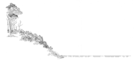
River and bottomlands: drawing of river and bottomland habitat. One of a four part series.
River and bottomlands: drawing of river and bottomland habitat. One of a four part series.
Abbr=EX
U.S. National Park Service
Project=North Unit Contact Station; Reflective Art
Government owns art and all reproduction rights.
Public domain
Image
Theodore Roosevelt National Park, Code: THRO
Theodore Roosevelt National Park, North Dakota
Latitude: 46.9522094726563, Longitude: -103.459701538086
Latitude: 46.9522094726563, Longitude: -103.459701538086
Image Management System : IMS 10186
20190904
Exhibit 5/Graphic # TR-G-0504
Q9
Public Can View
Organization: Harpers Ferry Center
Address: Harpers Ferry Center, 67 Mather Place, Harpers Ferry, WV, 25425, 304-535-5050
Address: Harpers Ferry Center, 67 Mather Place, Harpers Ferry, WV, 25425, 304-535-5050
Friday, October 4, 2019 12:11:06 PM
Friday, October 4, 2019 12:11:06 PM
10186.jpg
jpg
31.6 kB
Museum