Select Item below to DOWNLOAD - Once item is selected, right click and choose 'save as'
d64aa8901905475d8d58248192b8d6bb
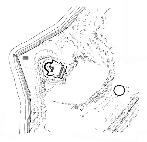
Aerial view of Fort Warburton as it would have appeared c1814.
Aerial view of Fort Warburton as it would have appeared c1814.
Abbr=EX
U.S. National Park Service
Project=Fort Warblurton ; Reflective Art
Government owns art and all reproduction rights.
Public domain
Image
Fort Washington Park, Code: FOWA
Fort Washington Park, Prince George's County, Maryland
Latitude: 38.7122001647949, Longitude: -77.0287017822266
Latitude: 38.7122001647949, Longitude: -77.0287017822266
Image Management System : IMS 09391
20190904
Graphic # FW-G-109
P6
Public Can View
Organization: Harpers Ferry Center
Address: Harpers Ferry Center, 67 Mather Place, Harpers Ferry, WV, 25425, 304-535-5050
Address: Harpers Ferry Center, 67 Mather Place, Harpers Ferry, WV, 25425, 304-535-5050
Monday, October 7, 2019 2:36:16 PM
Monday, October 7, 2019 2:36:16 PM
09391.jpg
jpg
65.6 kB
Museum