Select Item below to DOWNLOAD - Once item is selected, right click and choose 'save as'
c7dd83d3-a40d-4b41-bb79-5969455bd46f
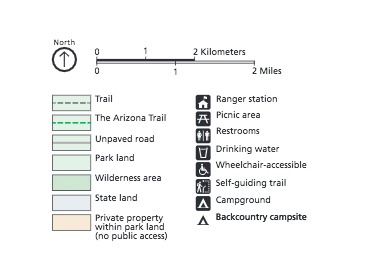
Legend - Saguaro National Park
Legend of the map of Saguaro National Park in Arizona.
Screen-viewable file; Adobe print production files can be downloaded from the Compressed zip Version link
Map Projection: Other; Map Type: unassigned
U.S. National Park Service
The National Park Service maps are government produced and are in the public domain. Anyone may, without restriction under U.S. copyright laws: Reproduce the work in print or digital form; Create derivative works; Perform the work publicly; Display the work; Distribute copies or digitally transfer the work to the public by sale or other transfer of ownership, or by rental, lease, or lending. Please note, a user who modifies and/or republishes National Park Service maps are responsible for any problems encountered with the maps, due to their change or modification.
Public domain
Document
Saguaro National Park, Code: SAGU
Saguaro National Park, Pima County, Arizona
Latitude: 32.1789016723633, Longitude: -110.608001708984
Latitude: 32.1789016723633, Longitude: -110.608001708984
2018-06-22
Public Can View
Person: Harpers Ferry Center
Organization: US National Park Service
Address: Harpers Ferry Center, Harpers Ferry, WV
Email: HFC_Cartography@nps.gov
Organization: US National Park Service
Address: Harpers Ferry Center, Harpers Ferry, WV
Email: HFC_Cartography@nps.gov
Monday, May 2, 2022 10:26:48 PM
Friday, September 26, 2025 11:37:25 PM
SAGUmap3.pdf
pdf
89.0 kB
Map