Select Item below to DOWNLOAD - Once item is selected, right click and choose 'save as'
b1efe784-0d8a-463a-8e78-aaf3ae49bb54
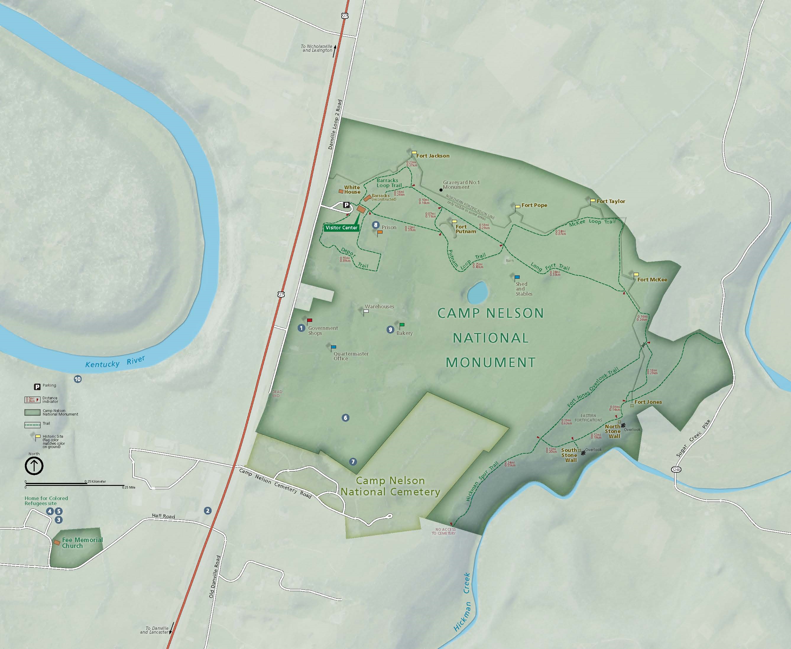
Park Map - Camp Nelson National Monument
Map of Camp Nelson National Monument in Kentucky. The park is shown in dark green and the surrounding areas in fainter green. Camp Nelson National Cemetery is shaded yellow, and the Kentucky River and Hickman Creek are represented in blue. Ten sites are numbered across the map, both in and outside of the park.
Screen-viewable file; Adobe print production files can be downloaded from the Compressed zip Version link
Map Type: unassigned
U.S. National Park Service
The National Park Service maps are government produced and are in the public domain. Anyone may, without restriction under U.S. copyright laws: Reproduce the work in print or digital form; Create derivative works; Perform the work publicly; Display the work; Distribute copies or digitally transfer the work to the public by sale or other transfer of ownership, or by rental, lease, or lending. Please note, a user who modifies and/or republishes National Park Service maps are responsible for any problems encountered with the maps, due to their change or modification.
Public domain
Document
Camp Nelson National Monument, Code: CANE
Camp Nelson National Monument, Kentucky
Camp Nelson National Monument
Camp Nelson National Monument
2022/10/01
10/01/2022
Public Can View
Person: Harpers Ferry Center
Organization: US National Park Service
Address: Harpers Ferry Center, Harpers Ferry, WV
Email: HFC_Cartography@nps.gov
Organization: US National Park Service
Address: Harpers Ferry Center, Harpers Ferry, WV
Email: HFC_Cartography@nps.gov
Wednesday, March 22, 2023 9:21:04 PM
Friday, September 26, 2025 11:34:24 PM
CANEmap1.pdf
pdf
18.1 MB
Map