Select Item below to DOWNLOAD - Once item is selected, right click and choose 'save as'
90c8ab3be21a4457aec6ea5dcc389e7a
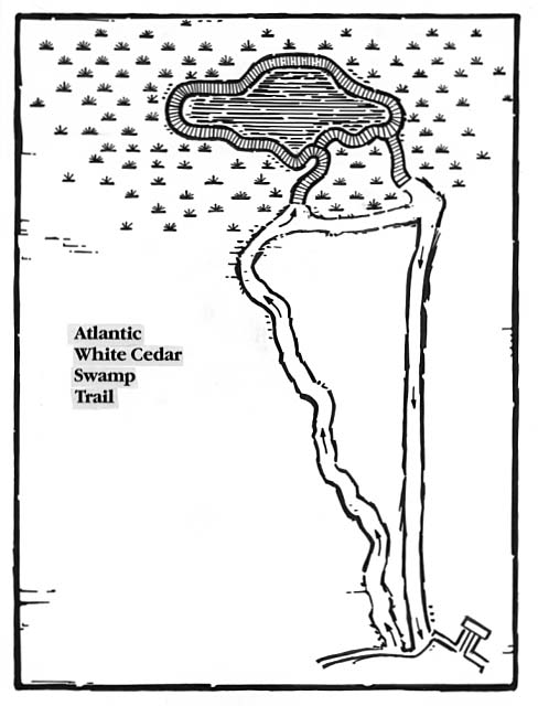
Map locating the Atlantic White Cedar Swamp Trail.
Map locating the Atlantic White Cedar Swamp Trail.
Abbr=EX
U.S. National Park Service
Project=Salt Pond; Art_Registration_No=EPD-0013 ; Reflective Art
Government owns art and all reproduction rights.
Public domain
Image
Cape Cod National Seashore, Code: CACO
Cape Cod National Seashore, Barnstable County, Massachusetts
Latitude: 41.959098815918, Longitude: -70.0053024291992
Latitude: 41.959098815918, Longitude: -70.0053024291992
Image Management System : IMS 06720
20190904
01/01/1988 - 12/30/1988
Graphic # CC-G-137 Illustration includes type positive
J7
Public Can View
Organization: Harpers Ferry Center
Address: Harpers Ferry Center, 67 Mather Place, Harpers Ferry, WV, 25425, 304-535-5050
Address: Harpers Ferry Center, 67 Mather Place, Harpers Ferry, WV, 25425, 304-535-5050
Monday, October 7, 2019 2:46:06 PM
Monday, October 7, 2019 2:46:06 PM
06720.jpg
jpg
50.1 kB
Museum