Select Item below to DOWNLOAD - Once item is selected, right click and choose 'save as'
The National Park Service is committed to making its electronic and information technologies accessible to individuals with disabilities.
If you require assistance or wish to report an issue related to the accessibility of any content on this website, please email NPGallery@nps.gov
If you require assistance or wish to report an issue related to the accessibility of any content on this website, please email NPGallery@nps.gov
8890a28b-7c0b-49bd-825f-0a474b68b975
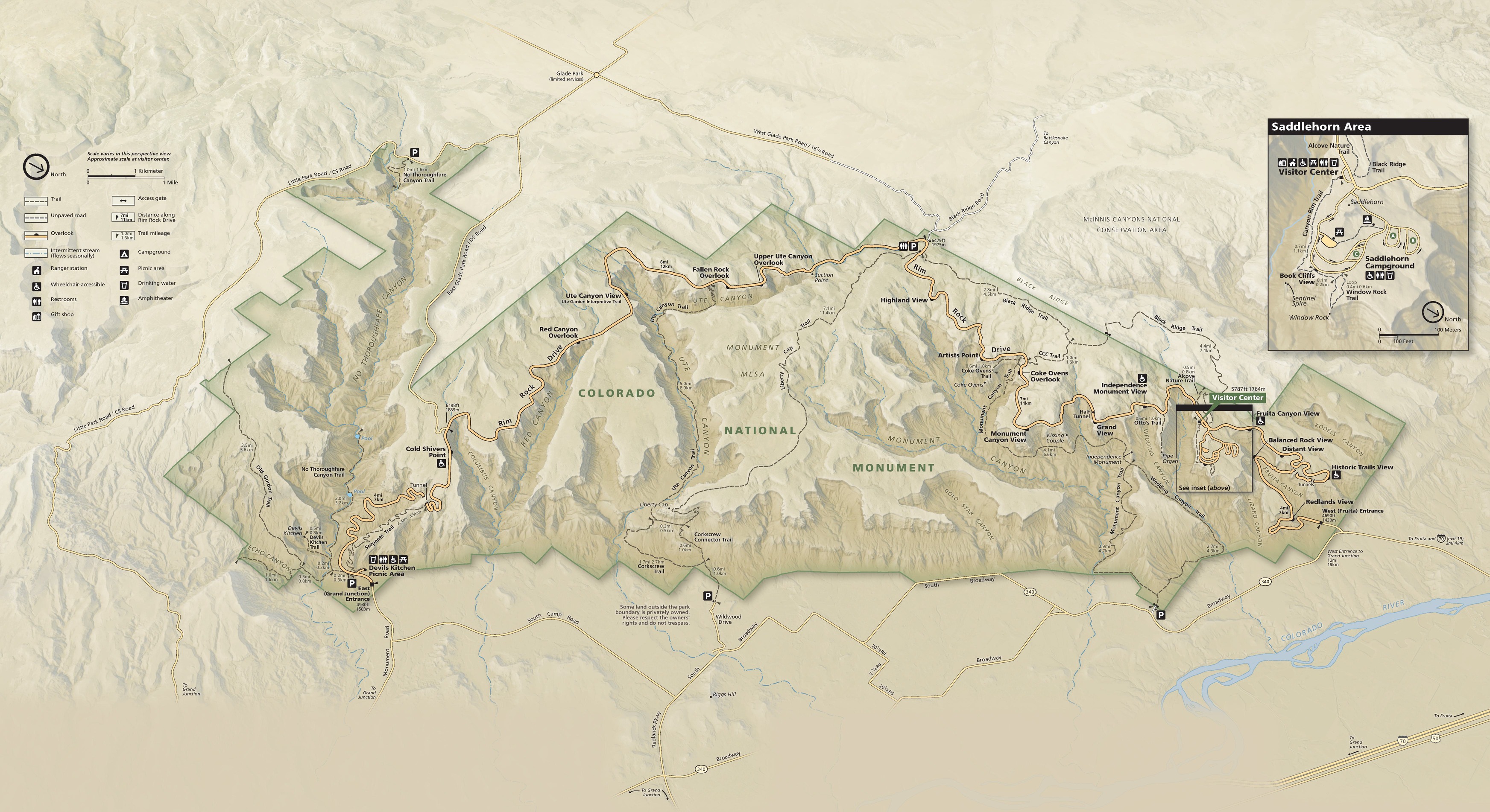
Park Map - Colorado National Monument
Map of Colorado National Monument in Colorado. The angular outline of the monument, which loosely resembles a teapot with the spout to the left, is green and the surrounding topography shades of tan and beige.
Screen-viewable file; Adobe print production files can be downloaded from the Compressed zip Version link
Map Projection: WM; Map Type: park map
U.S. National Park Service
The National Park Service maps are government produced and are in the public domain. Anyone may, without restriction under U.S. copyright laws: Reproduce the work in print or digital form; Create derivative works; Perform the work publicly; Display the work; Distribute copies or digitally transfer the work to the public by sale or other transfer of ownership, or by rental, lease, or lending. Please note, a user who modifies and/or republishes National Park Service maps are responsible for any problems encountered with the maps, due to their change or modification.
Public domain
Document
Colorado National Monument, Code: COLM
Colorado National Monument, Mesa County, Colorado
Latitude: 39.0503997802734, Longitude: -108.692001342773
Latitude: 39.0503997802734, Longitude: -108.692001342773
2023-02-01
02/01/2023
Public Can View
Person: Harpers Ferry Center
Organization: US National Park Service
Address: Harpers Ferry Center, Harpers Ferry, WV
Email: HFC_Cartography@nps.gov
Organization: US National Park Service
Address: Harpers Ferry Center, Harpers Ferry, WV
Email: HFC_Cartography@nps.gov
Monday, June 5, 2023 10:25:54 PM
Friday, September 26, 2025 11:34:39 PM
COLMmap1.pdf
pdf
100.0 MB
Map