Select Item below to DOWNLOAD - Once item is selected, right click and choose 'save as'
582a07b2933741f7bbca3de247e4a65a
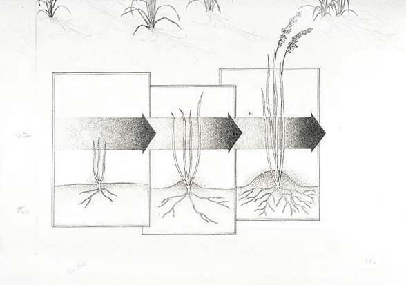
Sequential diagram of the growth of Sea oats.
Sequential diagram of the growth of Sea oats.
Illustrated with IMS # 05201; Abbr=WE
U.S. National Park Service
Project=Santa Rosa Island; Reflective Art
Government owns art and all reproduction rights.
Public domain
Image
Gulf Islands National Seashore, Code: GUIS
Gulf Islands National Seashore
Latitude: 30.3730602264404, Longitude: -86.9099731445313
Latitude: 30.3730602264404, Longitude: -86.9099731445313
Image Management System : IMS 05202
20190904
01/01/1985 - 12/30/1985
Image_Size=30" x 22"; Exhibit 27:"Traveling Dunes" Graphic # 27-4
P3
Public Can View
Organization: Harpers Ferry Center
Address: Harpers Ferry Center, 67 Mather Place, Harpers Ferry, WV, 25425, 304-535-5050
Address: Harpers Ferry Center, 67 Mather Place, Harpers Ferry, WV, 25425, 304-535-5050
Tuesday, October 8, 2019 2:13:16 PM
Tuesday, October 8, 2019 2:13:16 PM
05202.jpg
jpg
26.5 kB
Museum