Select Item below to DOWNLOAD - Once item is selected, right click and choose 'save as'
57bd7b7107d3415dad9c2a1230081bec
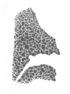
Silhouette of an aerial base map of the Chalmette area showing the cypress swamp and Mississippi River.
Silhouette of an aerial base map of the Chalmette area showing the cypress swamp and Mississippi River.
Abbr=WE
U.S. National Park Service
Project=Chalmette Unit ; Reflective Art
Government owns art and all reproduction rights.
Public domain
Image
Jean Lafitte National Historical Park and Preserve, Code: JELA
Jean Lafitte National Historical Park and Preserve, Louisiana
Latitude: 29.8020095825195, Longitude: -90.1701812744141
Latitude: 29.8020095825195, Longitude: -90.1701812744141
Image Management System : IMS 03749
20190904
01/01/1963 - 12/30/1963
Image_Size=11-1/2" x 14-3/4"; Marker #1: The Battle of New Orleans
A11
Public Can View
Organization: Harpers Ferry Center
Address: Harpers Ferry Center, 67 Mather Place, Harpers Ferry, WV, 25425, 304-535-5050
Address: Harpers Ferry Center, 67 Mather Place, Harpers Ferry, WV, 25425, 304-535-5050
Monday, October 7, 2019 2:59:35 PM
Monday, October 7, 2019 2:59:35 PM
03749.jpg
jpg
34.8 kB
Museum