Select Item below to DOWNLOAD - Once item is selected, right click and choose 'save as'
3617ecaa-71e3-4e27-a90e-b3cd74d4172f
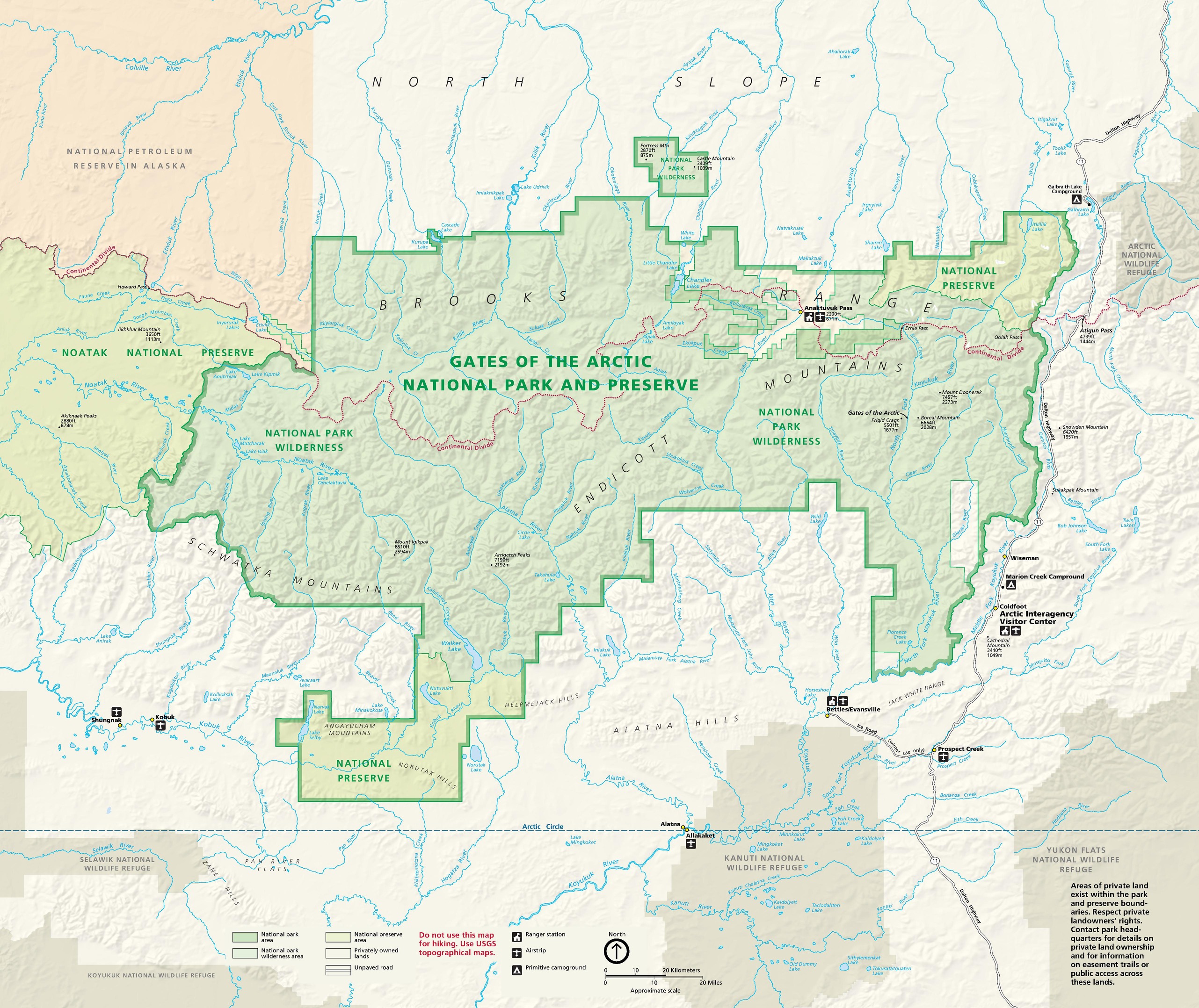
Park Map - Gates of the Arctic National Park and Preserve
Map of Gates of the Arctic National Park and Preserve in Alaska. Shown in green and surrounded in beige, the preserve has an irregular shape with stepped edges and is veined with dozens of rivers in blue.
Screen-viewable file; Adobe print production files can be downloaded from the Compressed zip Version link
Map Projection: WM; Map Type: park map
U.S. National Park Service
The National Park Service maps are government produced and are in the public domain. Anyone may, without restriction under U.S. copyright laws: Reproduce the work in print or digital form; Create derivative works; Perform the work publicly; Display the work; Distribute copies or digitally transfer the work to the public by sale or other transfer of ownership, or by rental, lease, or lending. Please note, a user who modifies and/or republishes National Park Service maps are responsible for any problems encountered with the maps, due to their change or modification.
Public domain
Document
Gates of the Arctic National Park and Preserve, Code: GAAR
Gates of the Arctic National Park and Preserve, Alaska
Latitude: 67.8690032958984, Longitude: -153.386901855469
Latitude: 67.8690032958984, Longitude: -153.386901855469
2018-06-19
Public Can View
Person: Harpers Ferry Center
Organization: US National Park Service
Address: Harpers Ferry Center, Harpers Ferry, WV
Email: HFC_Cartography@nps.gov
Organization: US National Park Service
Address: Harpers Ferry Center, Harpers Ferry, WV
Email: HFC_Cartography@nps.gov
Tuesday, April 26, 2022 8:47:12 PM
Friday, September 26, 2025 11:35:19 PM
GAARmap1.pdf
pdf
36.5 MB
Map