Select Item below to DOWNLOAD - Once item is selected, right click and choose 'save as'
32024d89-1048-45ce-a4e8-5b9aeef16dc2
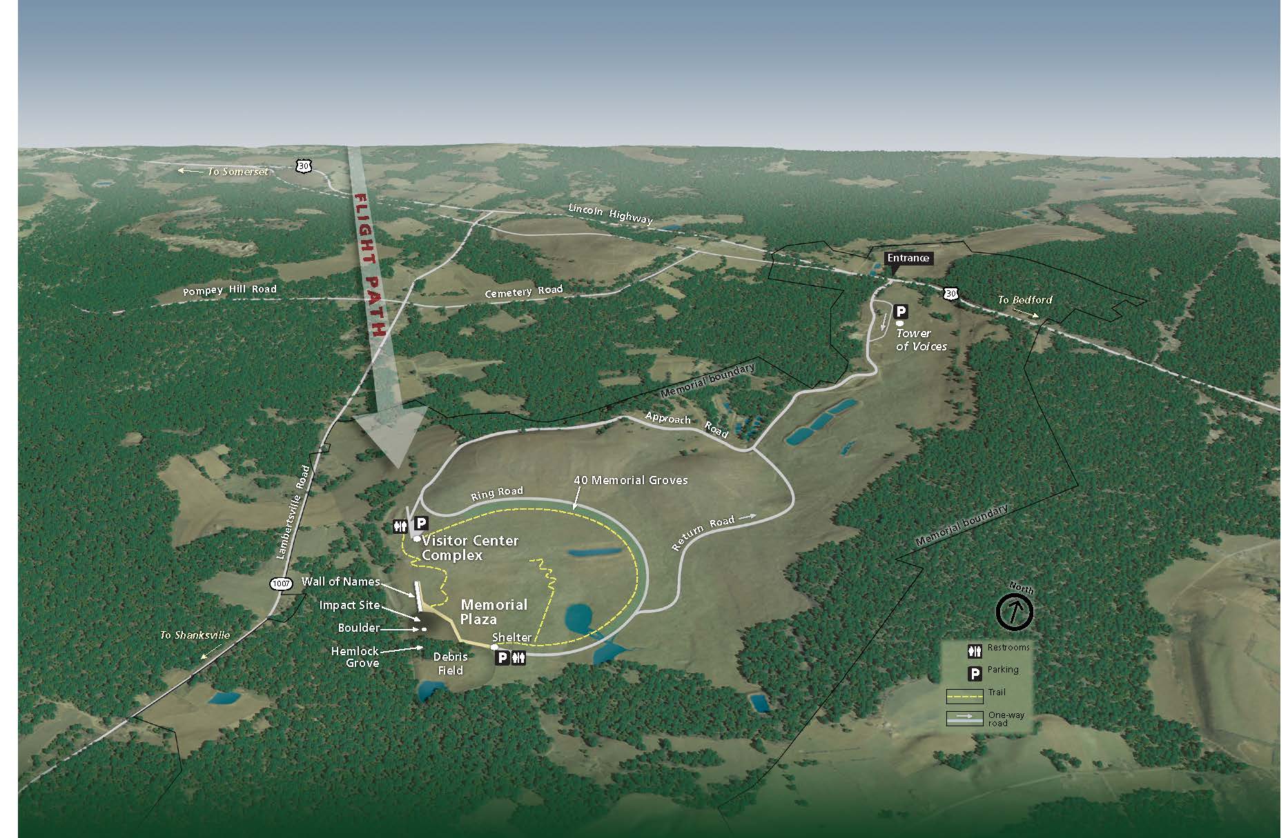
Bird's-Eye View Park Map - Flight 93 National Memorial
Map showing a bird’s-eye-view of the Flight 93 National Memorial in Pennsylvania. The park is an open area mostly surrounded by a carpet of dense trees. White lines represent roads, and yellow dashed lines represent trails.
Screen-viewable file; Adobe print production files can be downloaded from the Compressed zip Version link
Map Projection: Other; Map Type: unassigned
U.S. National Park Service
The National Park Service maps are government produced and are in the public domain. Anyone may, without restriction under U.S. copyright laws: Reproduce the work in print or digital form; Create derivative works; Perform the work publicly; Display the work; Distribute copies or digitally transfer the work to the public by sale or other transfer of ownership, or by rental, lease, or lending. Please note, a user who modifies and/or republishes National Park Service maps are responsible for any problems encountered with the maps, due to their change or modification.
Public domain
Document
Flight 93 National Memorial, Code: FLNI
Flight 93 National Memorial, Somerset County, Pennsylvania
Latitude: 40.0606002807617, Longitude: -78.8945999145508
Latitude: 40.0606002807617, Longitude: -78.8945999145508
2021/07/01
Public Can View
Person: Harpers Ferry Center
Organization: US National Park Service
Address: Harpers Ferry Center, Harpers Ferry, WV
Email: HFC_Cartography@nps.gov
Organization: US National Park Service
Address: Harpers Ferry Center, Harpers Ferry, WV
Email: HFC_Cartography@nps.gov
Tuesday, April 26, 2022 2:00:46 PM
Friday, September 26, 2025 11:35:03 PM
FLNImap1.pdf
pdf
685.5 kB
Map