Select Item below to DOWNLOAD - Once item is selected, right click and choose 'save as'
295c9bcc0dba4843a280de29df500614
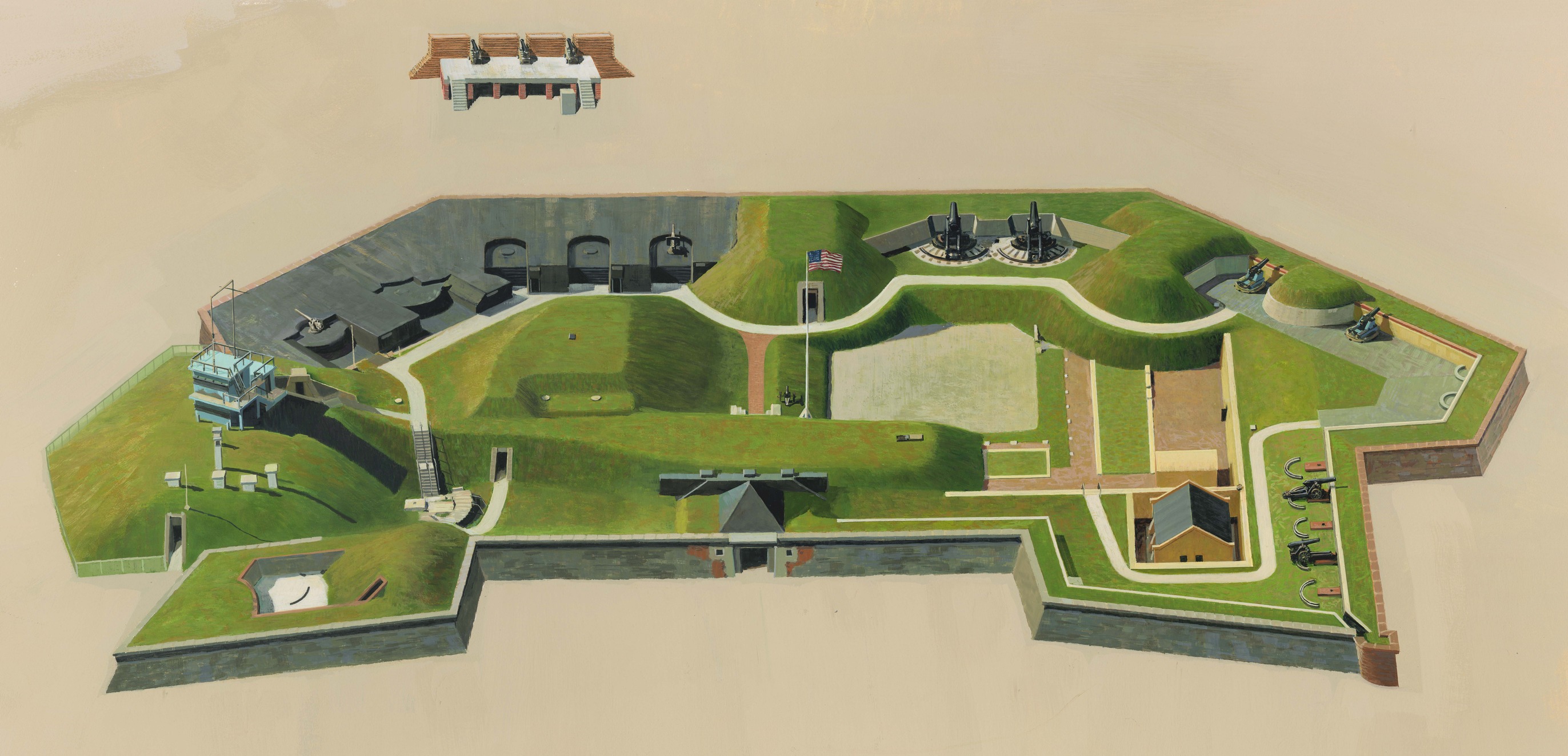
Aerial of Fort Moultrie, about 1983
Aerial of Fort Moultrie, about 1983
Aerial perspective of the fort and near grounds showing its weapons placements and harbor defense system. Illustration includes an unpublished detail depicts gun emplacements as they would have appeared at Fort Moultrie I, about 1776 or Fort Moultrie II, about 1798. Illustration published until 1998 when it was replaced with a digital derivative (see IMS #10802).
Used in unigrid park brochure until 1998 when the original image was replaced with a digital derivative (see IMS #10802). Illustration suitable as a diagram of the fort and its weapons placement and for use as a visitor "map" of the site. Value upon completion includes modifications/corrections made in 1985 under Order Number PX-1100-5-0589 for $400.00.; Abbr=PUB
U.S. National Park Service
Project=Folder ; Reflective Art
Government owns art and all reproduction rights.
Public domain
Image
Fort Moultrie National Monument, Code: FOMO
Fort Moultrie National Monument, Charleston County, South Carolina
Latitude: 32.7585105895996, Longitude: -79.8576126098633
Latitude: 32.7585105895996, Longitude: -79.8576126098633
Image Management System : IMS 10801
20190904
1979/1985
Image_Size=31-7/8" x18- 15/16"; Count:1/1; Fort Moultrie unigrid brochure until 1998
MC CC
Public Can View
Organization: Harpers Ferry Center
Address: Harpers Ferry Center, 67 Mather Place, Harpers Ferry, WV, 25425, 304-535-5050
Address: Harpers Ferry Center, 67 Mather Place, Harpers Ferry, WV, 25425, 304-535-5050
Monday, October 7, 2019 2:00:12 PM
Monday, October 7, 2019 2:00:12 PM
10801.jpg
jpg
2.7 MB
Museum