Select Item below to DOWNLOAD - Once item is selected, right click and choose 'save as'
2060bc2bdbf34107bbea83ffd8b5e2b6
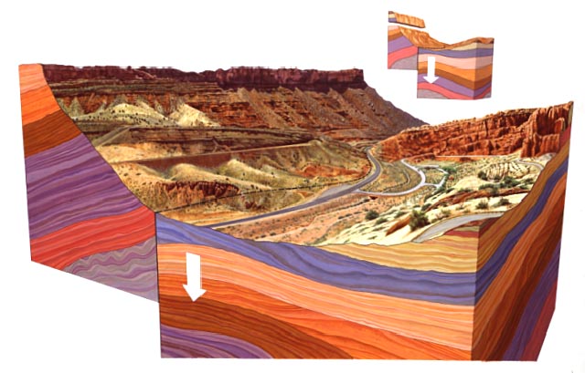
Moab Fault with a cross-section of the various rock layers including Chinle Formation, Cutler Formation, Navajo Sandstone, Entrada Sandstone, Kayenta, Wingate, Moenkopi, and Honaker Trail.
Moab Fault with a cross-section of the various rock layers including Chinle Formation, Cutler Formation, Navajo Sandstone, Entrada Sandstone, Kayenta, Wingate, Moenkopi, and Honaker Trail.
Abbr=WE
U.S. National Park Service
Art_Registration_No=WE-0148 ; Reflective Art
Government owns art and all reproduction rights.
Public domain
Image
Arches National Park, Code: ARCH
Arches National Park, Grand County, Utah
Latitude: 38.7224998474121, Longitude: -109.585998535156
Latitude: 38.7224998474121, Longitude: -109.585998535156
Image Management System : IMS 08667
20190904
01/01/1994 - 12/30/1994
Image_Size=24" x 16"; Count:1/2; Exhibit 2/Graphic # 2-7
P14
Public Can View
Organization: Harpers Ferry Center
Address: Harpers Ferry Center, 67 Mather Place, Harpers Ferry, WV, 25425, 304-535-5050
Address: Harpers Ferry Center, 67 Mather Place, Harpers Ferry, WV, 25425, 304-535-5050
Monday, October 7, 2019 2:40:06 PM
Monday, October 7, 2019 2:40:06 PM
08667.jpg
jpg
60.0 kB
Museum