Select Item below to DOWNLOAD - Once item is selected, right click and choose 'save as'
1fe70b41-8920-4744-a1b6-203c12fe84eb
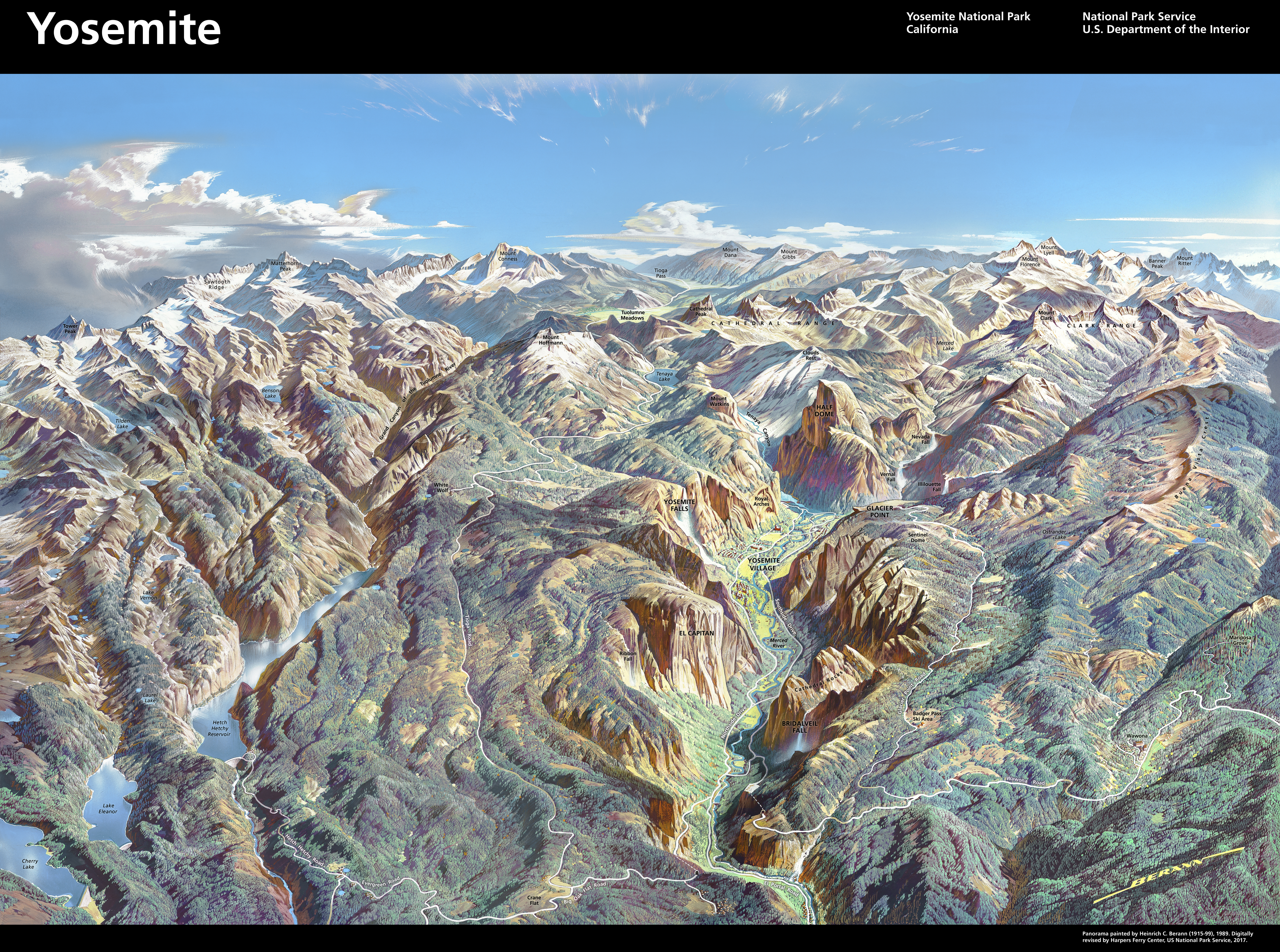
Yosemite Berann panorama - with labels
Painted panorama of Yosemite National Park in California. Sunlight pours across ridges, valleys, waterfalls, and rivers painted in tones of earthy green and brown under a vibrant blue sky.
Screen-viewable file
Map Type: Berann panorama; Map Type: other
U.S. National Park Service
The National Park Service maps are government produced and are in the public domain. Anyone may, without restriction under U.S. copyright laws: Reproduce the work in print or digital form; Create derivative works; Perform the work publicly; Display the work; Distribute copies or digitally transfer the work to the public by sale or other transfer of ownership, or by rental, lease, or lending. Please note, a user who modifies and/or republishes National Park Service maps are responsible for any problems encountered with the maps, due to their change or modification.
Public domain
Image
Yosemite National Park, Code: YOSE
Yosemite National Park, California
Latitude: 37.8399200439453, Longitude: -119.540397644043
Latitude: 37.8399200439453, Longitude: -119.540397644043
2017-07-21
Public Can View
Person: Harpers Ferry Center
Organization: US National Park Service
Address: Harpers Ferry Center, Harpers Ferry, WV
Email: HFC_Cartography@nps.gov
Organization: US National Park Service
Address: Harpers Ferry Center, Harpers Ferry, WV
Email: HFC_Cartography@nps.gov
Tuesday, August 23, 2022 4:52:36 PM
Friday, September 26, 2025 11:38:22 PM
YOSE_Berann_labels.jpeg
jpeg
103.8 MB
Map