Select Item below to DOWNLOAD - Once item is selected, right click and choose 'save as'
1f741512-bbc2-46c0-b767-0d0b6865242f
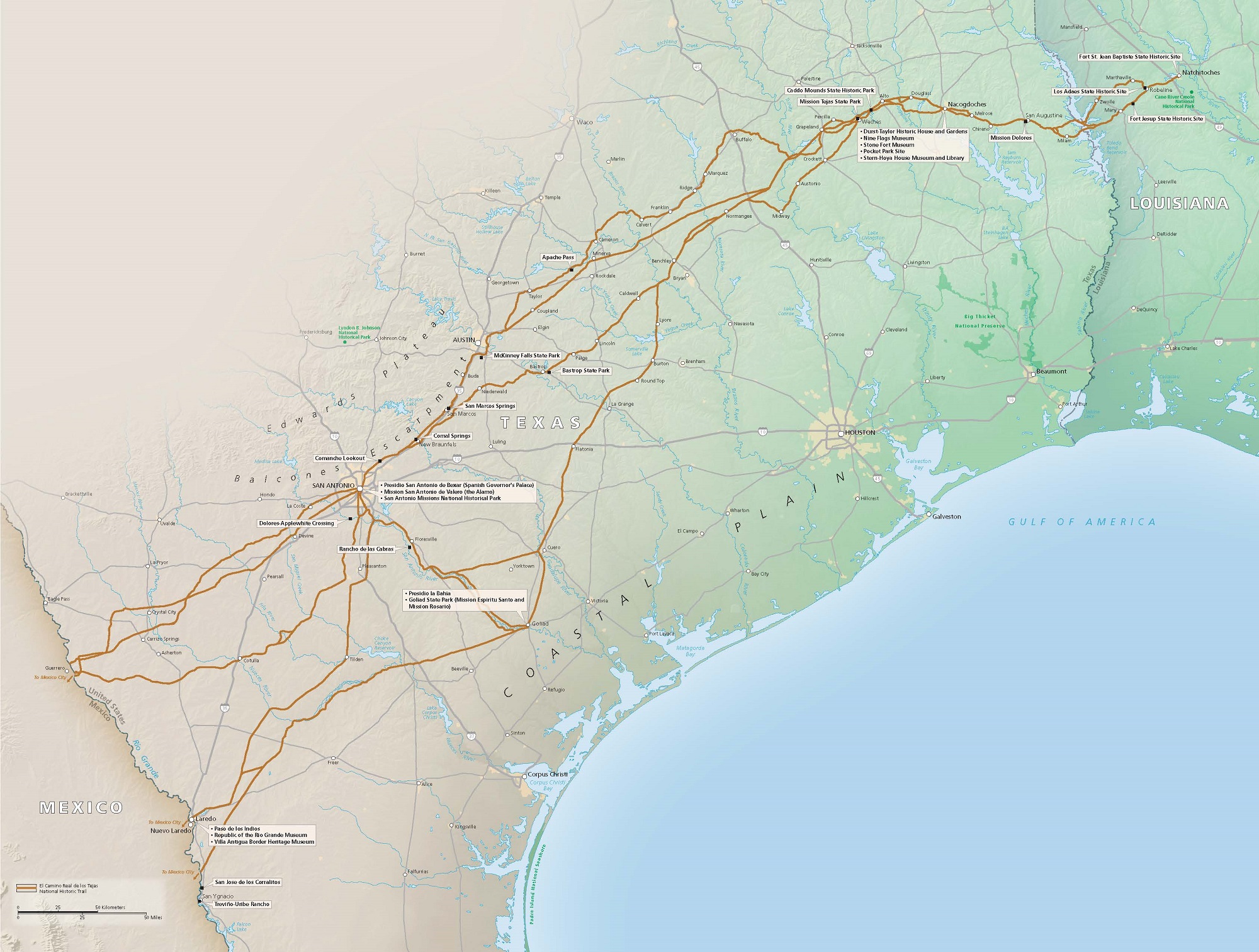
Trail Map - El Camino Real de los Tejas National Historic Trail
Map of the El Camino Real de los Tejas National Historic Trail, a route that encompasses thirty historic sites and parks from Natchitoches, Louisiana, through Texas, and to the border of Mexico. Land near the blue water is green and it shifts to brown inland and to the south.
Screen-viewable file; Adobe print production files can be downloaded from the Compressed zip Version link
Map Projection: Other; Map Type: unassigned
U.S. National Park Service
The National Park Service maps are government produced and are in the public domain. Anyone may, without restriction under U.S. copyright laws: Reproduce the work in print or digital form; Create derivative works; Perform the work publicly; Display the work; Distribute copies or digitally transfer the work to the public by sale or other transfer of ownership, or by rental, lease, or lending. Please note, a user who modifies and/or republishes National Park Service maps are responsible for any problems encountered with the maps, due to their change or modification.
Public domain
Document
El Camino Real de los Tejas National Historic Trail, Code: ELTE
Texas, El Camino Real de los Tejas National Historic Trail, Louisiana
Latitude: 31.61669921875, Longitude: -93.4026031494141
Latitude: 31.61669921875, Longitude: -93.4026031494141
2025/02/12
Public Can View
Person: Harpers Ferry Center
Organization: US National Park Service
Address: Harpers Ferry Center, Harpers Ferry, WV
Email: HFC_Cartography@nps.gov
Organization: US National Park Service
Address: Harpers Ferry Center, Harpers Ferry, WV
Email: HFC_Cartography@nps.gov
Thursday, February 13, 2025 1:13:13 PM
Thursday, February 13, 2025 1:13:13 PM
ELTEmap1.pdf
pdf
22.6 MB
Map