Select Item below to DOWNLOAD - Once item is selected, right click and choose 'save as'
1a6af5e548e04d1d847d76a6e798e518
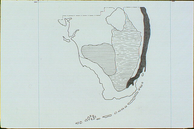
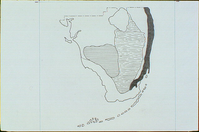
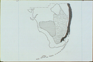
Partial map of Florida highlighting Lake Okeechobee, Big Cypress Swamp (horizontal lines), Everglades (broken horizontal lines), Coastal Prairie, Mangrove Swamp, and Pine Rockland.
Partial map of Florida highlighting Lake Okeechobee, Big Cypress Swamp (horizontal lines), Everglades (broken horizontal lines), Coastal Prairie, Mangrove Swamp, and Pine Rockland.
Abbr=WE
U.S. National Park Service
Project=Gumbo-Limbo Trail ; Reflective Art
Government owns art and all reproduction rights.
Public domain
Image
Everglades National Park, Code: EVER
Everglades National Park, Florida
Latitude: 25.2717704772949, Longitude: -80.953498840332
Latitude: 25.2717704772949, Longitude: -80.953498840332
Image Management System : IMS 00466
20190904
01/01/1980 - 12/30/1980
Image_Size=W: 9 5/8" x H: 10 15/16"; Metric_Size=W: 22.84CM X H: 25.38CM; Exhibit 2
E2
Public Can View
Organization: Harpers Ferry Center
Address: Harpers Ferry Center, 67 Mather Place, Harpers Ferry, WV, 25425, 304-535-5050
Address: Harpers Ferry Center, 67 Mather Place, Harpers Ferry, WV, 25425, 304-535-5050
Monday, October 7, 2019 3:10:52 PM
Monday, October 7, 2019 3:10:52 PM
00466.JPG
jpg
47.4 kB
Museum