Select Item below to DOWNLOAD - Once item is selected, right click and choose 'save as'
13482d3583f54030bff7507226ab000e
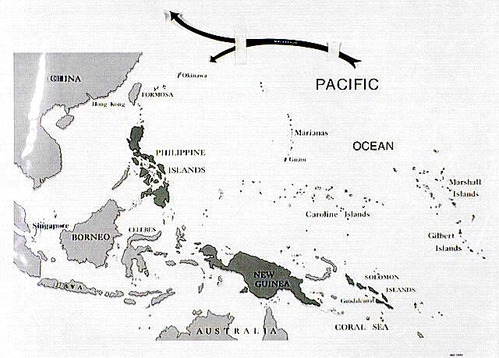
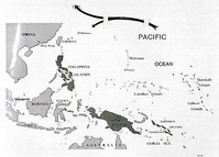
Map with type overlay showing General Douglas MacArthur's movement in the Pacific Ocean
Map with type overlay showing General Douglas MacArthur's movement in the Pacific Ocean
Map highlights the Pacific Ocean, Coral Sea, China, Formosa, Okinawa, Hong Kong, Philippine Islands, Borneo, Singapore, Celebes, Java, Australia, New Guinea, Guadalcanal, Solomon Islands, Gilbert Islands, Caroline Islands, Guam, Marianas, and Marshall Islands.
Abbr=AVA
U.S. National Park Service
Reflective Art
Government owns art and all reproduction rights.
Public domain
Image
War in the Pacific National Historical Park, Code: WAPA
War in the Pacific National Historical Park, Guam , Guam
Latitude: 13.3905000686646, Longitude: 144.654006958008
Latitude: 13.3905000686646, Longitude: 144.654006958008
Image Management System : IMS 00989
20190904
Image_Size=W: 23 9/16" x H: 17"; Metric_Size=W: 58.38CM X H: 43.15CM; AVA Project #67, Plate 2
A6
Public Can View
Organization: Harpers Ferry Center
Address: Harpers Ferry Center, 67 Mather Place, Harpers Ferry, WV, 25425, 304-535-5050
Address: Harpers Ferry Center, 67 Mather Place, Harpers Ferry, WV, 25425, 304-535-5050
Monday, October 7, 2019 3:07:22 PM
Monday, October 7, 2019 3:07:22 PM
00989.jpg
jpg
63.9 kB
Museum