Select Item below to DOWNLOAD - Once item is selected, right click and choose 'save as'
e9e86de5-e1b4-47d6-9924-43acf3911bd5
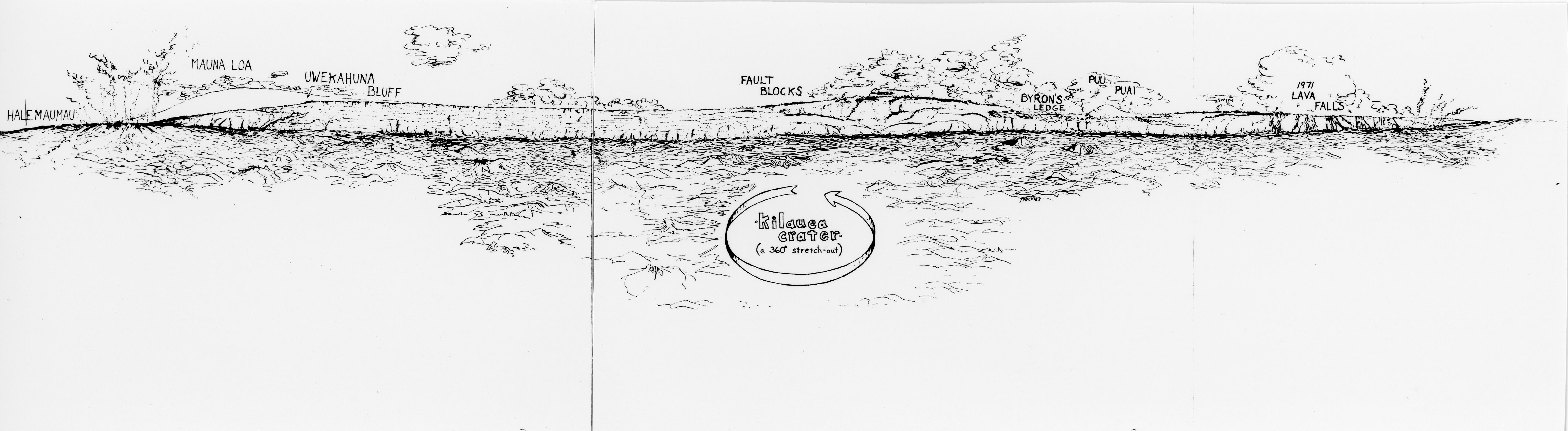
Kīlauea Crater 360 Stretch-Out
A black and white image of a drawing of Kīlauea crater. The drawing has labels along a roughly drawn crater edge and other volcanic landscapes. From the lefthand side of the image there is a label, "Halemaʻumaʻu." Next to the label there is a rocky landscape with smoke coming out of it. Next to the smoke is another label, "Mauna Loa." This label is high on a mountain away from the rest of the labels. Next, is " Uēkahuna Bluff." There is a line drawn under this label pointing towards a ridge line that continues across the image. "Fault Blocks" is seen as a rocky landscape with an arrow pointing to the right of it. Below this label there is a title for the drawing, " Kīlauea Crater a 360 stretch out" with an arrow going around the words in a circle. "Byron's Ledge" is located above a cliff in the ridge line. Next, “Puʻupuaʻi " is written in the center of smoke or a cloud. On the far-right side there is a label for the "1971 lava falls." This label is above a cliff edge with lava pouring over the sides.
A 360 degree drawing of Kīlauea crater including labels for areas of interest including Halemaʻumaʻu, Mauna Loa, Uēkahuna bluff, fault blocks, Uēaloha, Puʻupuaʻi , and 1971 lava falls.
Hawaiʻi Volcanoes National Park Museum and Archives
The copyright and related rights status of this Item has been reviewed by the organization that has made the Item available, but the organization was unable to make a conclusive determination as to the copyright status of the Item. Please refer to the organization that has made the Item available for more information. You are free to use this Item in any way that is permitted by the copyright and related rights legislation that applies to your use. Reference URI: http://rightsstatements.org/vocab/UND/1.0/
Unknown Photographer
Restrictions apply on use and/or reproduction:Copyright Undetermined. For more information about this digital asset, contact Hawaii Volcanoes National Park, Museum Program, at havo_archive_museum@nps.gov
Interpretation, (Hawaii Volcanoes Historic Image Collection Theme)
, Cultural Resources, (Hawaii Volcanoes Historic Image Collection Theme)
, Cultural Resources, (Hawaii Volcanoes Historic Image Collection Theme)
Image
Hawaii Volcanoes National Park, Code: HAVO
Hawaii Volcanoes National Park, Hawaii County, Hawaii
Latitude: 19.3775997161865, Longitude: -155.602996826172
Latitude: 19.3775997161865, Longitude: -155.602996826172
NPS Museum Catalog Number : HAVO 17707
Circa 1972/05/01-1991/01/31
01/01/1970 - 12/30/2000
Public Can View
Person: Museum Staff
Organization: Hawaiʻi Volcanoes National Park
Email: havo_archive_museum@nps.gov
Organization: Hawaiʻi Volcanoes National Park
Email: havo_archive_museum@nps.gov
Wednesday, January 10, 2024 6:06:13 PM
Thursday, February 1, 2024 6:29:03 PM
HAVO17707_B002f012_0026.tif
tif
19.6 MB
Historic