Select Item below to DOWNLOAD - Once item is selected, right click and choose 'save as'
63824acc-38e5-46f8-96c4-4f4675839fe9
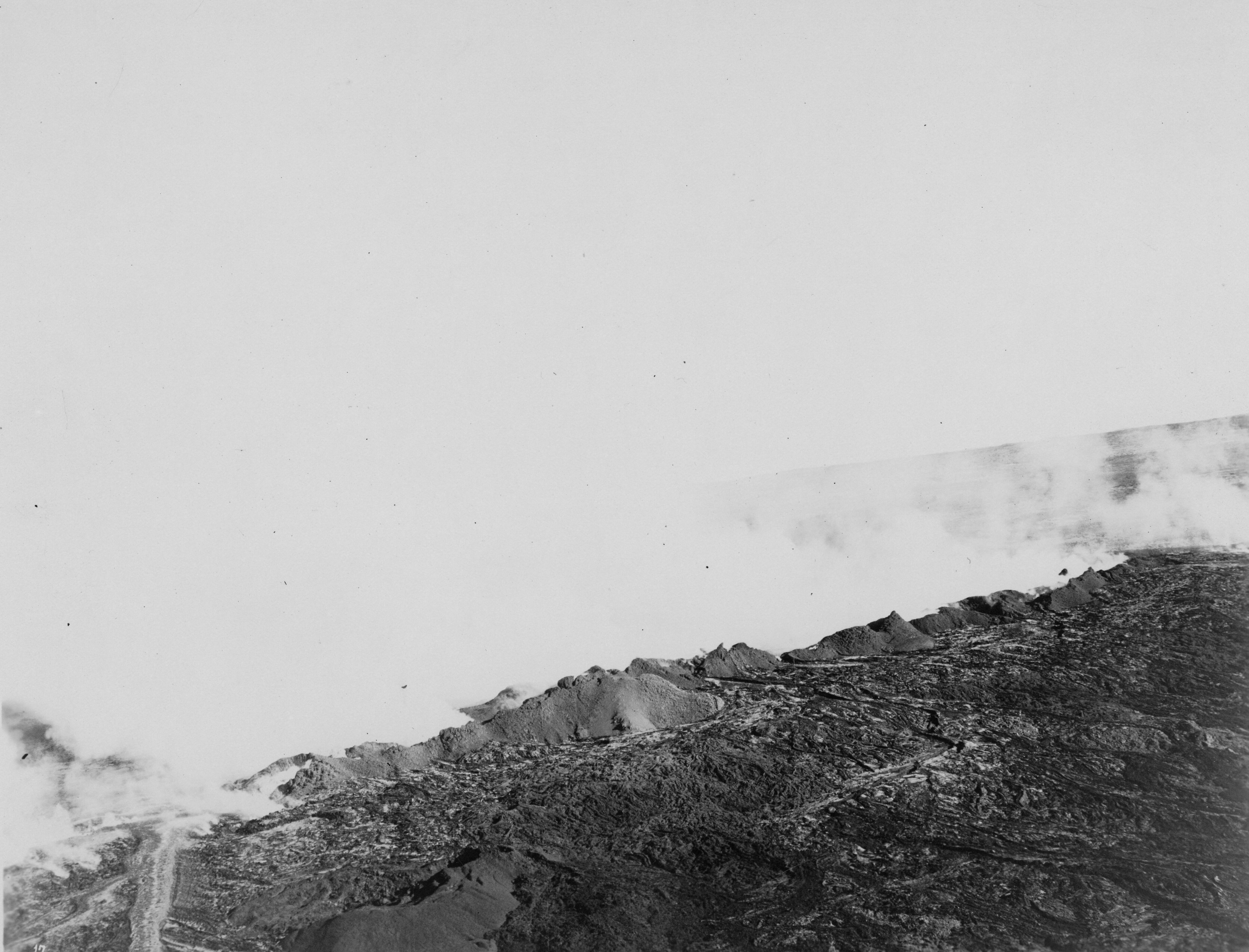
Mauna Loa Lava Rift, 1926
Black and white photograph of a landscape that is mostly obstructed by clouds of white smoke. Smoke takes up almost the entirety of the image and blends in with the sky, obstructing the location’s identification. The only visible piece of land is apparent at the bottom right. The land is rough and rocky and appears to be mostly dried lava. In the bottom left corner there is a flow of lava running down out of view. A piece of elevated land can be seen in the distance towards the right side, through gaps in the cloud of smoke.
The crater of Mauna Loa during an eruption, captured by the 11th Photo Section, Air Service USA on April 17, 1926.
Hawaiʻi Volcanoes National Park Museum and Archives
NO COPYRIGHT - UNITED STATES: The organization that has made the Item available believes that the Item is in the Public Domain under the laws of the United States, but a determination was not made as to its copyright status under the copyright laws of other countries. The Item may not be in the Public Domain under the laws of other countries. Please refer to the organization that has made the Item available for more information. Reference http://rightsstatements.org/vocab/NoC-US/1.0/
US Army Air Corps; 11th Photo Section
Restrictions apply on use and/or reproduction:NO COPYRIGHT. For more information about this digital asset, contact Hawaii Volcanoes National Park, Museum Program, at havo_archive_museum@nps.gov
Mauna Loa Eruptions (1903-1933), (Mauna Loa Eruptions)
Image
Hawaii Volcanoes National Park, Code: HAVO
Hawai'i
Hawaii Volcanoes National Park, Hawaii County, Hawaii
Latitude: 19.3775997161865, Longitude: -155.602996826172
Hawaii Volcanoes National Park, Hawaii County, Hawaii
Latitude: 19.3775997161865, Longitude: -155.602996826172
NPS Museum Catalog Number : HAVO 20724
1926/04/17
01/01/1911 - 12/30/1939
Public Can View
Organization: Hawaiʻi Volcanoes NP
Position: Curator
Address: 1 Crater Rim Drive, Hawaii National Park
Email: havo_archive_museum@nps.gov
Position: Curator
Address: 1 Crater Rim Drive, Hawaii National Park
Email: havo_archive_museum@nps.gov
Wednesday, April 17, 2024 3:52:11 PM
Wednesday, April 17, 2024 3:52:11 PM
HAVO20724_B005f001_0017a.tif
tif
26.2 MB
Historic