Select Item below to DOWNLOAD - Once item is selected, right click and choose 'save as'
bbf250ffd7984a95a6f921880f975616
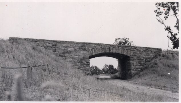
West side completed structure
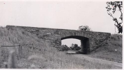
West side completed structure
Photographs from the Blue Ridge Parkway Final Construction Report, Project 1-K-5, July 30, 1942
U.S. National Park Service
Permission must be secured from the individual copyright owners to reproduce any copyrighted materials contained within this website.
Unknown
Public domain
Roadway, (Blue Ridge Parkway Construction Project)
, Overpass, (Blue Ridge Parkway Construction Project)
, Stone work, (Blue Ridge Parkway Construction Project)
, Overpass, (Blue Ridge Parkway Construction Project)
, Stone work, (Blue Ridge Parkway Construction Project)
Image
Blue Ridge Parkway, Code: BLRI
VA Route 617 at Bobblet's Gap, Milepost 93, Blue Ridge Parkway
Blue Ridge Parkway
Latitude: 36.4365005493164, Longitude: -81.070556640625
Blue Ridge Parkway
Latitude: 36.4365005493164, Longitude: -81.070556640625
circa 1940s
Public Can View
Organization: US National Park Service
Role: Museum Curator
Address: Blue Ridge Parkway Headquarters
Email: blri_info@nps.gov
Role: Museum Curator
Address: Blue Ridge Parkway Headquarters
Email: blri_info@nps.gov
Sunday, March 22, 2020 9:31:35 AM
Sunday, March 22, 2020 9:31:35 AM
BLRI_FinalConstrRpt_1K510.tif
tif
687.6 kB
Scenic
,
Historic