Select Item below to DOWNLOAD - Once item is selected, right click and choose 'save as'
b64ea6bd80964c68b68502ab841fdda7
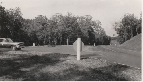
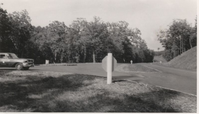
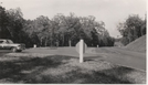
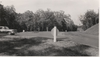
Completed pavement, showing parking overlook and roadway at Station 285
Completed pavement, showing parking overlook and roadway at Station 285
Photographs from the Blue Ridge Parkway Final Construction Report, Project 1F8-G15, May 24, 1962
U.S. National Park Service
Permission must be secured from the individual copyright owners to reproduce any copyrighted materials contained within this website.
Unknown
Public domain
Roadway, (Blue Ridge Parkway Construction Project)
Image
Blue Ridge Parkway, Code: BLRI
Section 1-G, Milepost 50.1-63.7, Blue Ridge Parkway
Blue Ridge Parkway
Latitude: 36.4365005493164, Longitude: -81.070556640625
Blue Ridge Parkway
Latitude: 36.4365005493164, Longitude: -81.070556640625
circa 1950s
Public Can View
Organization: US National Park Service
Role: Museum Curator
Address: Blue Ridge Parkway Headquarters
Email: blri_info@nps.gov
Role: Museum Curator
Address: Blue Ridge Parkway Headquarters
Email: blri_info@nps.gov
Sunday, March 22, 2020 9:51:43 AM
Sunday, March 22, 2020 9:51:43 AM
BLRI_FinalConstrRpt_1F805.tif
tif
1.1 MB
Scenic
,
Historic