Select Item below to DOWNLOAD - Once item is selected, right click and choose 'save as'
e7b7434f-67b9-41cd-af3a-2fff9f9f4070
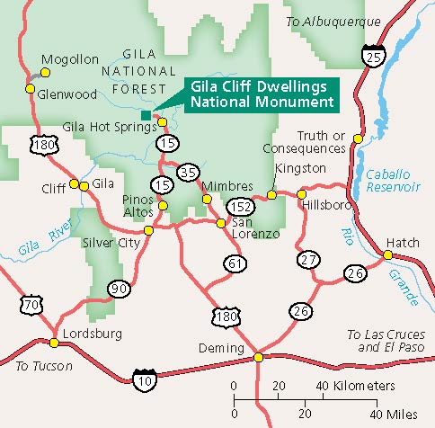
Area map - Gila Cliff Dwellings National Monument
Area map of Gila Cliff Dwellings National Monument in New Mexico. The park is represented by a green square within Gila National Forest, which is highlighted in green. The surrounding area is beige with roads represented by red lines and towns represented by yellow dots.
Screen-viewable file; Adobe print production files can be downloaded from the Compressed zip Version link
Map Projection: Other; Map Type: area
U.S. National Park Service
The National Park Service maps are government produced and are in the public domain. Anyone may, without restriction under U.S. copyright laws: Reproduce the work in print or digital form; Create derivative works; Perform the work publicly; Display the work; Distribute copies or digitally transfer the work to the public by sale or other transfer of ownership, or by rental, lease, or lending. Please note, a user who modifies and/or republishes National Park Service maps are responsible for any problems encountered with the maps, due to their change or modification.
Public domain
Document
Gila Cliff Dwellings National Monument, Code: GICL
Gila Cliff Dwellings National Monument, Catron County, New Mexico
Latitude: 33.2276000976563, Longitude: -108.273002624512
Latitude: 33.2276000976563, Longitude: -108.273002624512
2025/05/22
Public Can View
Person: Harpers Ferry Center
Organization: US National Park Service
Address: Harpers Ferry Center, Harpers Ferry, WV
Email: HFC_Cartography@nps.gov
Organization: US National Park Service
Address: Harpers Ferry Center, Harpers Ferry, WV
Email: HFC_Cartography@nps.gov
Friday, May 23, 2025 1:13:13 PM
Friday, September 26, 2025 11:35:23 PM
GICLmap2.pdf
pdf
312.8 kB
Map