Select Item below to DOWNLOAD - Once item is selected, right click and choose 'save as'
dbd6c0a1-d11b-4fcc-9adb-ffece21f6a2d
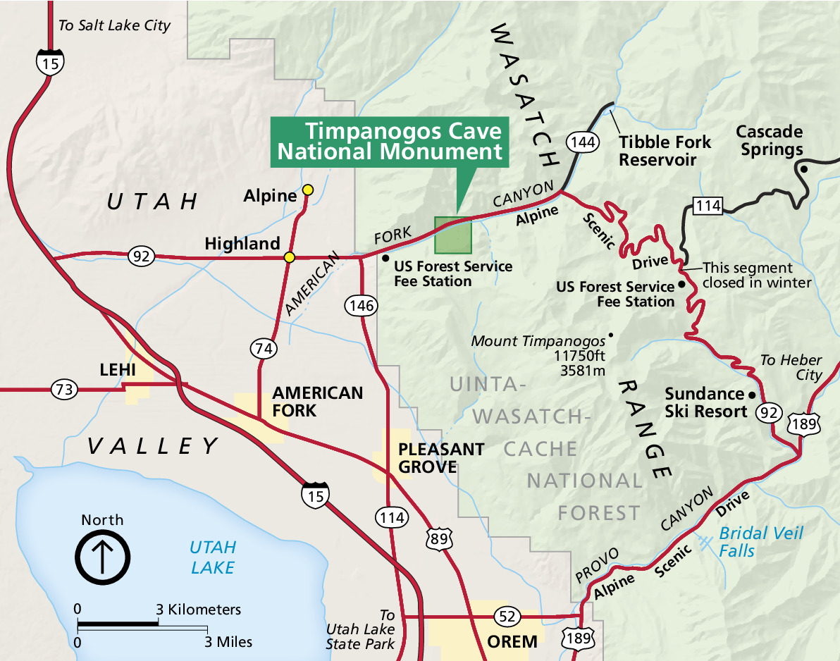
Park Map - Timpanogos Cave National Monument
Map of Timpanogos Cave National Monument Utah. The park is a darker green square in the much larger Uinta-Wasatch-Cache National Forest, which is shown in paler green on the right half of the map. Utah Valley is shown in tan to the left, and Utah Lake is represented in blue in the lower corner.
Screen-viewable file
Map Projection: Other; Map Type: unassigned
U.S. National Park Service
The National Park Service maps are government produced and are in the public domain. Anyone may, without restriction under U.S. copyright laws: Reproduce the work in print or digital form; Create derivative works; Perform the work publicly; Display the work; Distribute copies or digitally transfer the work to the public by sale or other transfer of ownership, or by rental, lease, or lending. Please note, a user who modifies and/or republishes National Park Service maps are responsible for any problems encountered with the maps, due to their change or modification.
Public domain
Document
Timpanogos Cave National Monument, Code: TICA
Timpanogos Cave National Monument, Utah County, Utah
Latitude: 40.4403991699219, Longitude: -111.708999633789
Latitude: 40.4403991699219, Longitude: -111.708999633789
2017-03-15
Public Can View
Person: Harpers Ferry Center
Organization: US National Park Service
Address: Harpers Ferry Center, Harpers Ferry, WV
Email: HFC_Cartography@nps.gov
Organization: US National Park Service
Address: Harpers Ferry Center, Harpers Ferry, WV
Email: HFC_Cartography@nps.gov
Monday, May 2, 2022 10:41:49 PM
Friday, September 26, 2025 11:37:49 PM
TICAmap1.pdf
pdf
997.3 kB
Map