Select Item below to DOWNLOAD - Once item is selected, right click and choose 'save as'
bc7451f0-85be-4a60-84e3-d9abb1761842
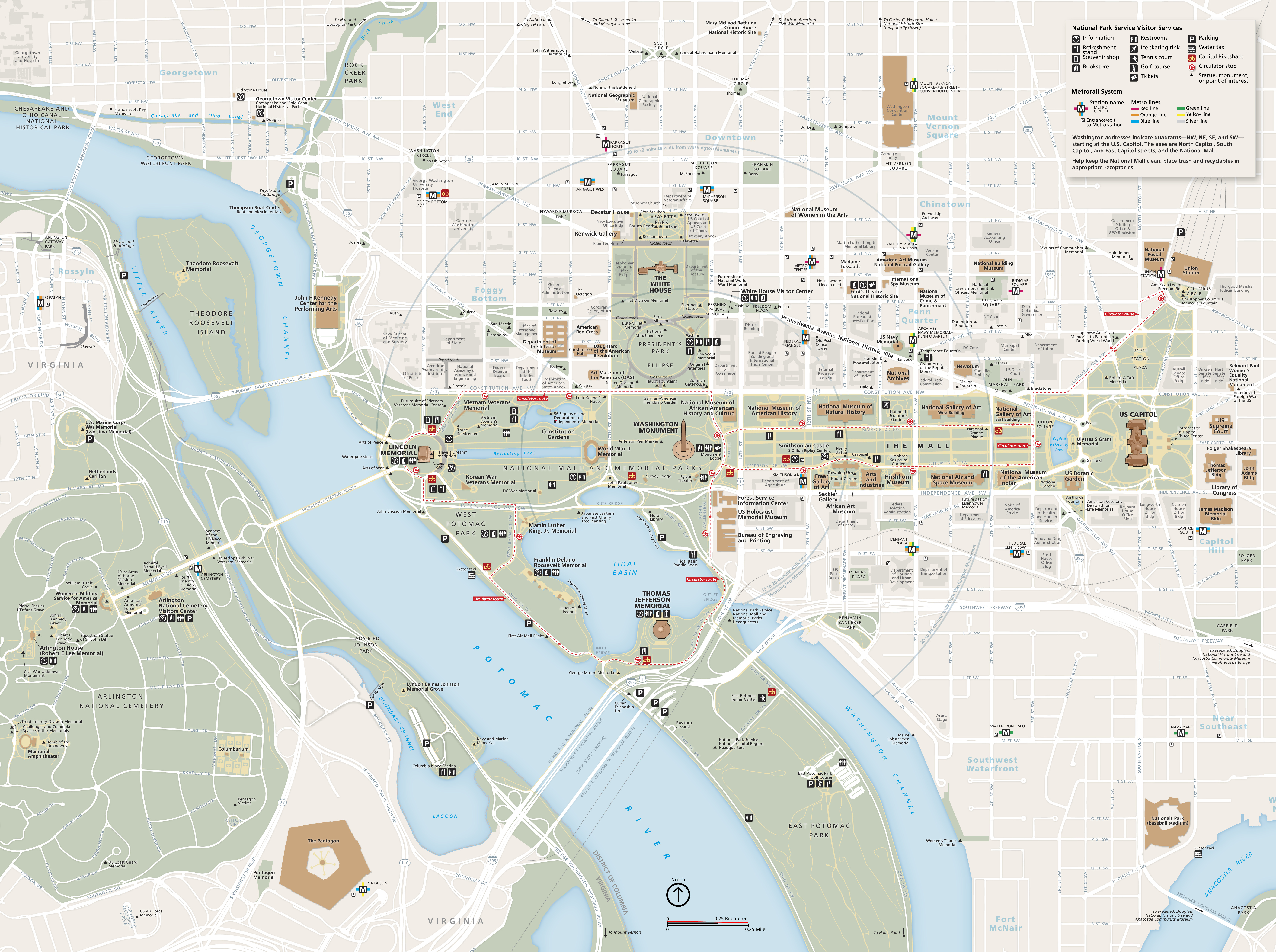
National Mall Mobile App Map - National Mall and Memorial Parks
Map of the National Mall and Memorial Parks in Washington, DC. The Potomac River crosses the map diagonally from near the top left corner to the bottom center of the map. Most of the roads make a grid around hundreds of named sites, Metro stations, buildings, and roads.
Screen-viewable file; Adobe print production files can be downloaded from the Compressed zip Version link
Map Projection: Other; Map Type: unassigned
U.S. National Park Service
The National Park Service maps are government produced and are in the public domain. Anyone may, without restriction under U.S. copyright laws: Reproduce the work in print or digital form; Create derivative works; Perform the work publicly; Display the work; Distribute copies or digitally transfer the work to the public by sale or other transfer of ownership, or by rental, lease, or lending. Please note, a user who modifies and/or republishes National Park Service maps are responsible for any problems encountered with the maps, due to their change or modification.
Public domain
Document
National Mall and Memorial Parks, Code: NAMA
District of Columbia , District of Columbia
Latitude: 38.8900451660156, Longitude: -77.0189971923828
Latitude: 38.8900451660156, Longitude: -77.0189971923828
2018-06-20
Public Can View
Person: Harpers Ferry Center
Organization: US National Park Service
Address: Harpers Ferry Center, Harpers Ferry, WV
Email: HFC_Cartography@nps.gov
Organization: US National Park Service
Address: Harpers Ferry Center, Harpers Ferry, WV
Email: HFC_Cartography@nps.gov
Wednesday, April 27, 2022 9:10:48 PM
Friday, September 26, 2025 11:36:43 PM
NAMAmap1.pdf
pdf
11.3 MB
Map