Select Item below to DOWNLOAD - Once item is selected, right click and choose 'save as'
ba97de5b-db77-4df5-abae-2695ea436a31
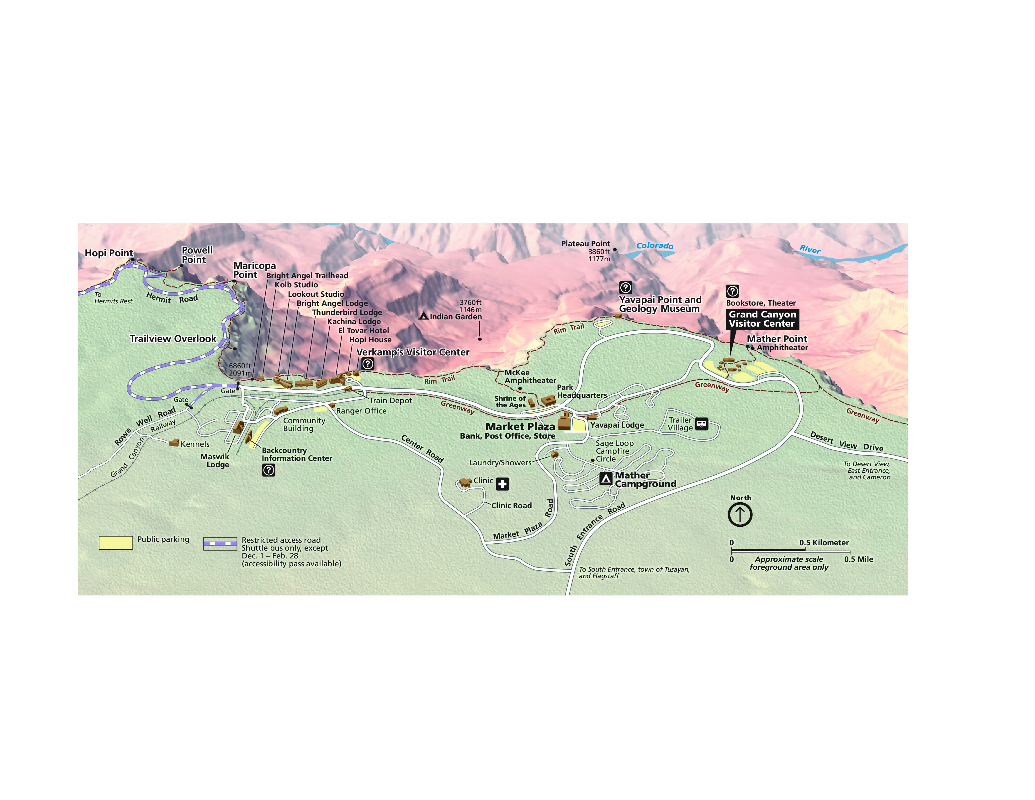
South Rim Grand Canyon Village Detail Map - Grand Canyon National Park
Map of Grand Canyon National Monument in Arizona. The plateau along the bottom edge of the map is sage green and the canyons beyond are rendered in shades of brown.
Screen-viewable file; Adobe print production files can be downloaded from the Compressed zip Version link
Map Projection: Other; Map Type: unassigned
U.S. National Park Service
The National Park Service maps are government produced and are in the public domain. Anyone may, without restriction under U.S. copyright laws: Reproduce the work in print or digital form; Create derivative works; Perform the work publicly; Display the work; Distribute copies or digitally transfer the work to the public by sale or other transfer of ownership, or by rental, lease, or lending. Please note, a user who modifies and/or republishes National Park Service maps are responsible for any problems encountered with the maps, due to their change or modification.
Public domain
Document
Grand Canyon National Park, Code: GRCA
Grand Canyon National Park, Arizona
Latitude: 36.3291397094727, Longitude: -112.790603637695
Latitude: 36.3291397094727, Longitude: -112.790603637695
2013-06-17
Public Can View
Person: Harpers Ferry Center
Organization: US National Park Service
Address: Harpers Ferry Center, Harpers Ferry, WV
Email: HFC_Cartography@nps.gov
Organization: US National Park Service
Address: Harpers Ferry Center, Harpers Ferry, WV
Email: HFC_Cartography@nps.gov
Tuesday, April 26, 2022 8:36:40 PM
Friday, September 26, 2025 11:35:32 PM
GRCAmap4.pdf
pdf
3.9 MB
Map