Select Item below to DOWNLOAD - Once item is selected, right click and choose 'save as'
7a34893bb9784314945e3bd7b66d8eb9
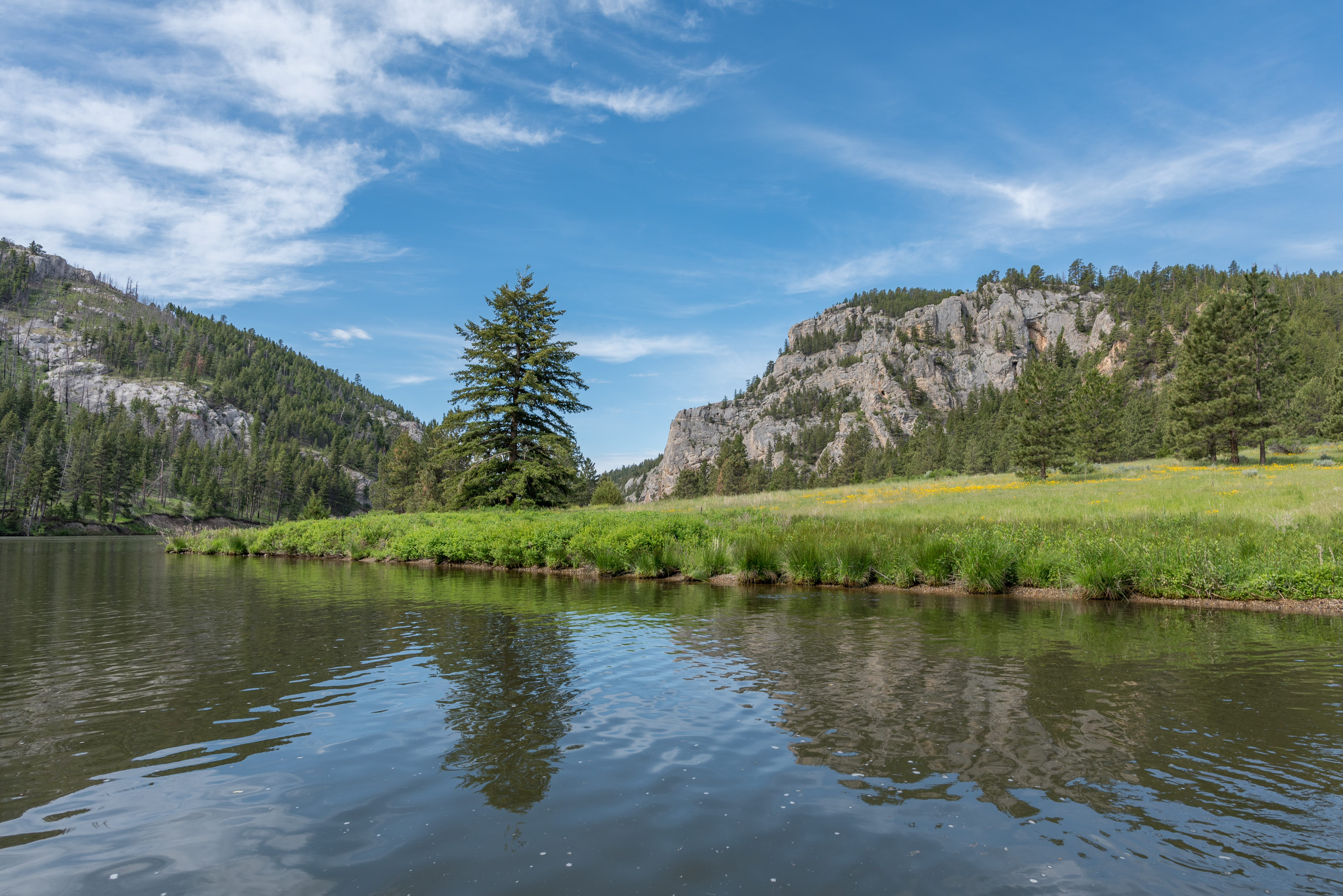
Gates of the Mountains shoreline
The Missouri River winds around a meadow with wildlfowers and conifers. White cliffs in the distance.
Shoreline of Gates of the Mountains, Montana
U.S. National Park Service
This digital asset is in the public domain. When publishing this asset for any use, including online, image must credit: Courtesy U.S. National Parks
Public domain
Image
Lewis and Clark National Historic Trail, Code: LECL
Gates of the Mountains, Montana
Lewis and Clark National Historic Trail
Latitude: 40.6641616821289, Longitude: -95.8320693969727
Lewis and Clark National Historic Trail
Latitude: 40.6641616821289, Longitude: -95.8320693969727
20180607
06/07/2018
Public Can View
Organization: Lewis and Clark National Historic Trail
Address: 601 Riverfront Dr. , Omaha, NE, USA, 68102, (402) 661-1804
Email: lecl_information@nps.gov
Address: 601 Riverfront Dr. , Omaha, NE, USA, 68102, (402) 661-1804
Email: lecl_information@nps.gov
Friday, June 19, 2020 4:12:25 PM
Friday, June 19, 2020 4:12:25 PM
DSC_0529.jpg
jpg
12.6 MB
Scenic