Select Item below to DOWNLOAD - Once item is selected, right click and choose 'save as'
4dab287c-0e31-4f80-bab6-3c377ed2d780
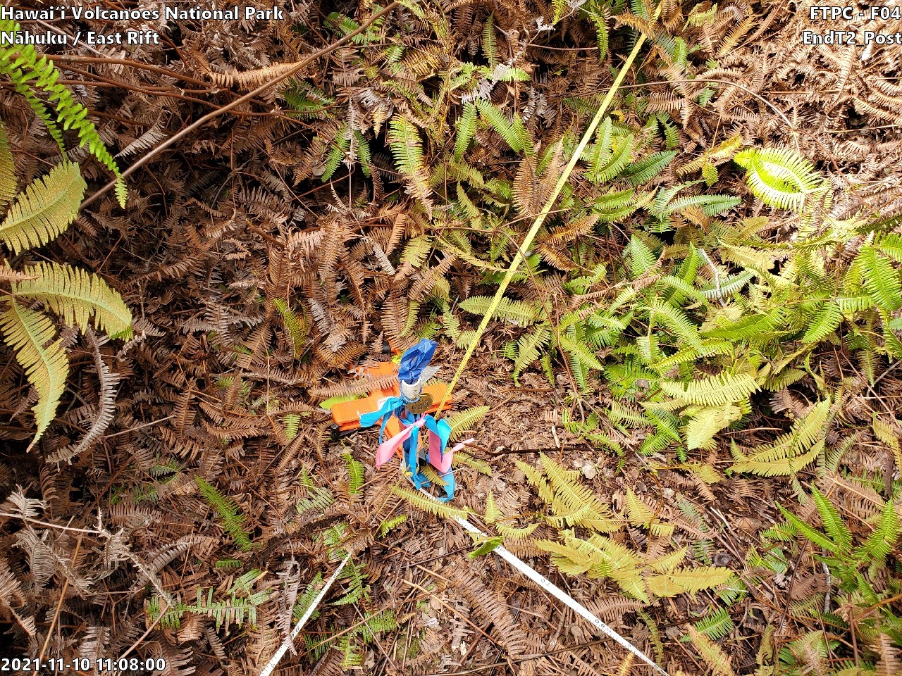
Wet Forest Nāhuku/East Rift: Site F04 - EndT2_Post, 2021
Photo of plot marker for relocation
FTPC HAVO Wet Forest Nāhuku/East Rift: Fixed Site 4 - EndT2_Post
U.S. National Park Service
Copyright free and in the public domain
NPS Photo / Jasmine-Marie Moku
Public domain
Wet Forest, (PACN-CommunityType)
, Nahuku/East Rift, (PACN-SamplingFrameName)
, Nāhuku/East Rift, (PACN-SamplingFrameNameDiacritical)
, Fixed, (PACN-PlotType)
, 4, (PACN-Transect)
, Focal Terrestrial Plant Communities, (PACN-ProtocolName)
, Nahuku/East Rift, (PACN-SamplingFrameName)
, Nāhuku/East Rift, (PACN-SamplingFrameNameDiacritical)
, Fixed, (PACN-PlotType)
, 4, (PACN-Transect)
, Focal Terrestrial Plant Communities, (PACN-ProtocolName)
Image
Pacific Island Network, Code: PACN
Hawaii Volcanoes National Park, Code: HAVO
Hawaii Volcanoes National Park, Code: HAVO
Hawaiʻi Volcanoes National Park
Hawaii Volcanoes National Park, Hawaii County, Hawaii
Latitude: 19.3775997161865, Longitude: -155.602996826172
Hawaii Volcanoes National Park, Hawaii County, Hawaii
Latitude: 19.3775997161865, Longitude: -155.602996826172
11/10/2021 11:08
01/01/2021 - 12/30/2021
Public Can View
Person: Botanist
Organization: US National Park Service
Address: Pacific Island Network, Hawaiʻi National Park, HI 96718
Organization: US National Park Service
Address: Pacific Island Network, Hawaiʻi National Park, HI 96718
Tuesday, January 23, 2024 12:04:00 AM
Tuesday, January 23, 2024 12:04:00 AM
20211110_F04_EndT2_Post_002.jpg
jpg
3.7 MB
Monitoring