Select Item below to DOWNLOAD - Once item is selected, right click and choose 'save as'
44bce41e-9519-41b9-b28d-2f09853132c4
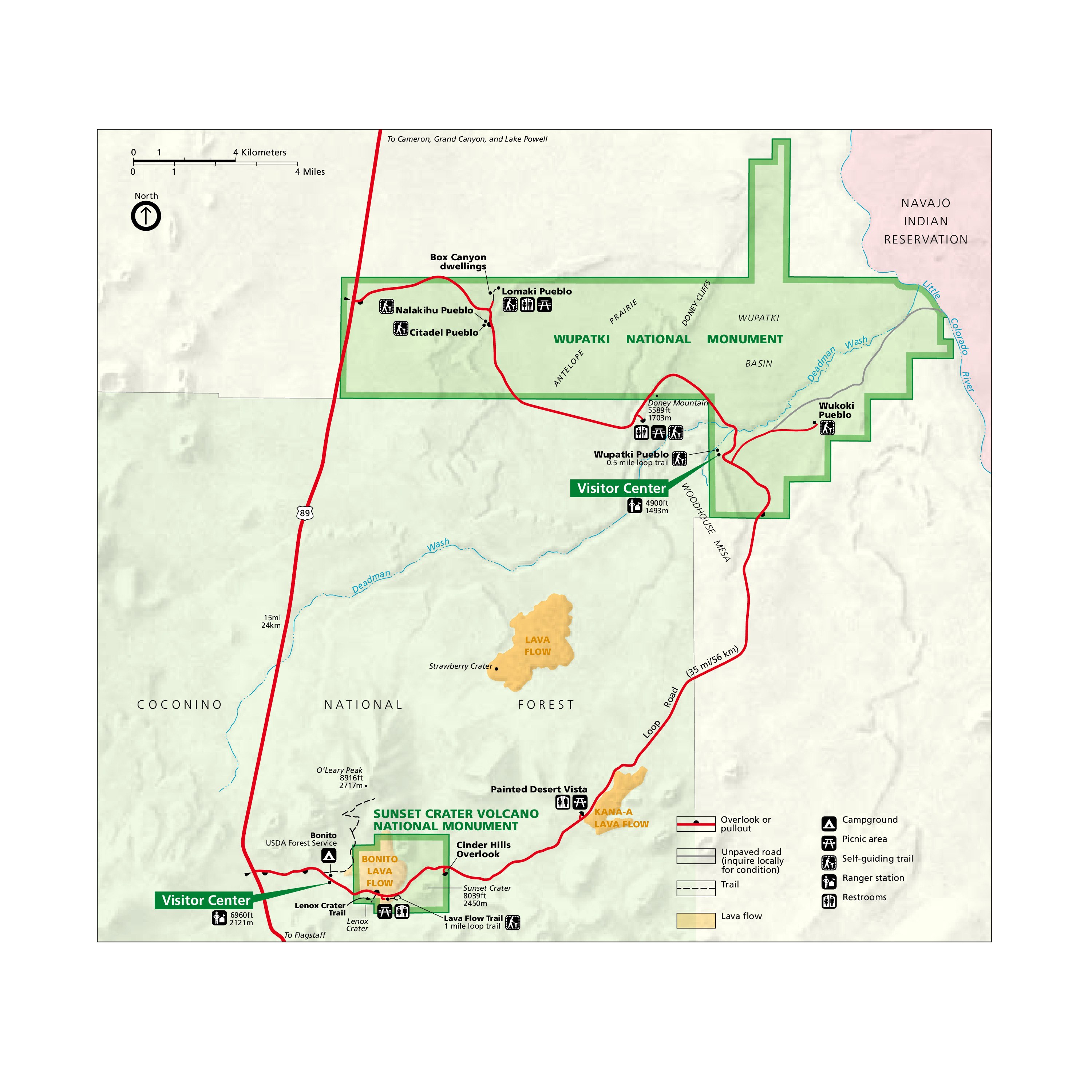
Park Map - Wupatki National Monument
Map of Wupatki National Monument in Arizona, which is outlined in green and shows the area’s topography. The monument is nestled between the Coconino National Forest to the southwest and the Navajo Indian Reservation to the northeast.
Screen-viewable file; Adobe print production files can be downloaded from the Compressed zip Version link
Map Projection: Other; Map Type: unassigned
U.S. National Park Service
The National Park Service maps are government produced and are in the public domain. Anyone may, without restriction under U.S. copyright laws: Reproduce the work in print or digital form; Create derivative works; Perform the work publicly; Display the work; Distribute copies or digitally transfer the work to the public by sale or other transfer of ownership, or by rental, lease, or lending. Please note, a user who modifies and/or republishes National Park Service maps are responsible for any problems encountered with the maps, due to their change or modification.
Public domain
Document
Wupatki National Monument, Code: WUPA
Wupatki National Monument, Coconino County, Arizona
Latitude: 35.5611991882324, Longitude: -111.403999328613
Latitude: 35.5611991882324, Longitude: -111.403999328613
2011-04-05
Public Can View
Person: Harpers Ferry Center
Organization: US National Park Service
Address: Harpers Ferry Center, Harpers Ferry, WV
Email: HFC_Cartography@nps.gov
Organization: US National Park Service
Address: Harpers Ferry Center, Harpers Ferry, WV
Email: HFC_Cartography@nps.gov
Monday, May 2, 2022 10:59:57 PM
Friday, September 26, 2025 11:38:19 PM
WUPAmap1.pdf
pdf
152.6 kB
Map