Select Item below to DOWNLOAD - Once item is selected, right click and choose 'save as'
The National Park Service is committed to making its electronic and information technologies accessible to individuals with disabilities.
If you require assistance or wish to report an issue related to the accessibility of any content on this website, please email NPGallery@nps.gov
If you require assistance or wish to report an issue related to the accessibility of any content on this website, please email NPGallery@nps.gov
2d23d9a1-1dc8-423e-b058-1b67cc15b8ae
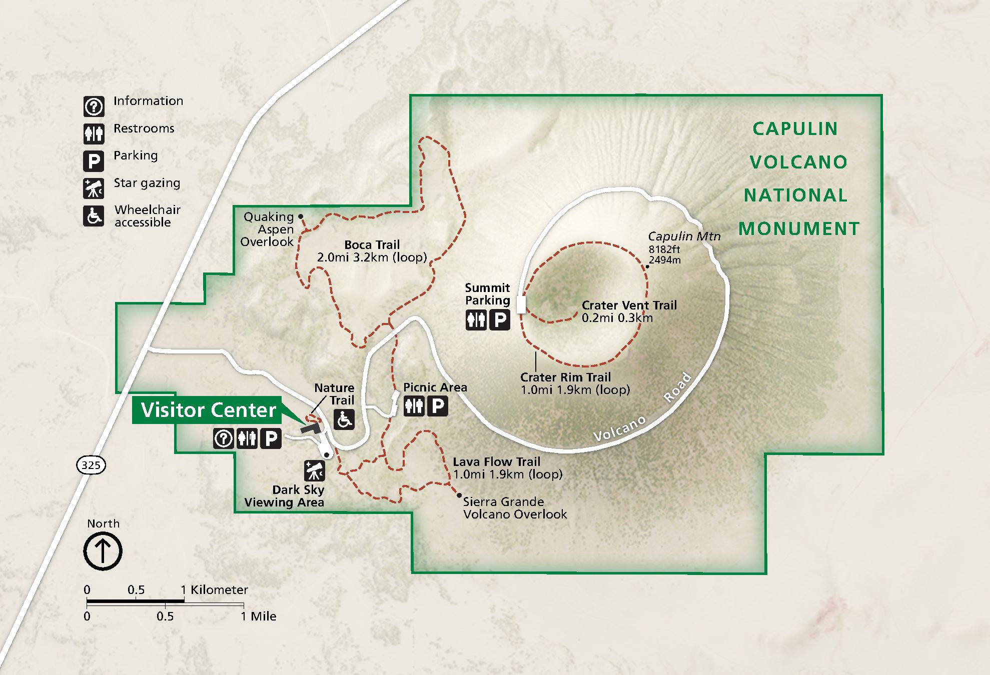
Park Map - Capulin Volcano National Monument
Map of Capulin Volcano National Monument in New Mexico. The park is shaded green within the dark green boundaries, which are stepped around a crater that nearly fills the park. Trails are represented by red dashed lines and a park road as a white line. The terrain around the park is beige.
Screen-viewable file; Adobe print production files can be downloaded from the Compressed zip Version link
Map Projection: WM; Map Type: park map
U.S. National Park Service
The National Park Service maps are government produced and are in the public domain. Anyone may, without restriction under U.S. copyright laws: Reproduce the work in print or digital form; Create derivative works; Perform the work publicly; Display the work; Distribute copies or digitally transfer the work to the public by sale or other transfer of ownership, or by rental, lease, or lending. Please note, a user who modifies and/or republishes National Park Service maps are responsible for any problems encountered with the maps, due to their change or modification.
Public domain
Document
Capulin Volcano National Monument, Code: CAVO
Capulin Volcano National Monument, Union County, New Mexico
Latitude: 36.7817001342773, Longitude: -103.971000671387
Latitude: 36.7817001342773, Longitude: -103.971000671387
2022-08-01
08/01/2022
Public Can View
Person: Harpers Ferry Center
Organization: US National Park Service
Address: Harpers Ferry Center, Harpers Ferry, WV
Email: HFC_Cartography@nps.gov
Organization: US National Park Service
Address: Harpers Ferry Center, Harpers Ferry, WV
Email: HFC_Cartography@nps.gov
Friday, July 28, 2023 5:18:04 PM
Friday, September 26, 2025 11:34:28 PM
CAVOmap1.pdf
pdf
4.6 MB
Map