Select Item below to DOWNLOAD - Once item is selected, right click and choose 'save as'
1712ea15-e9aa-4462-be1d-bc9c90b3c208
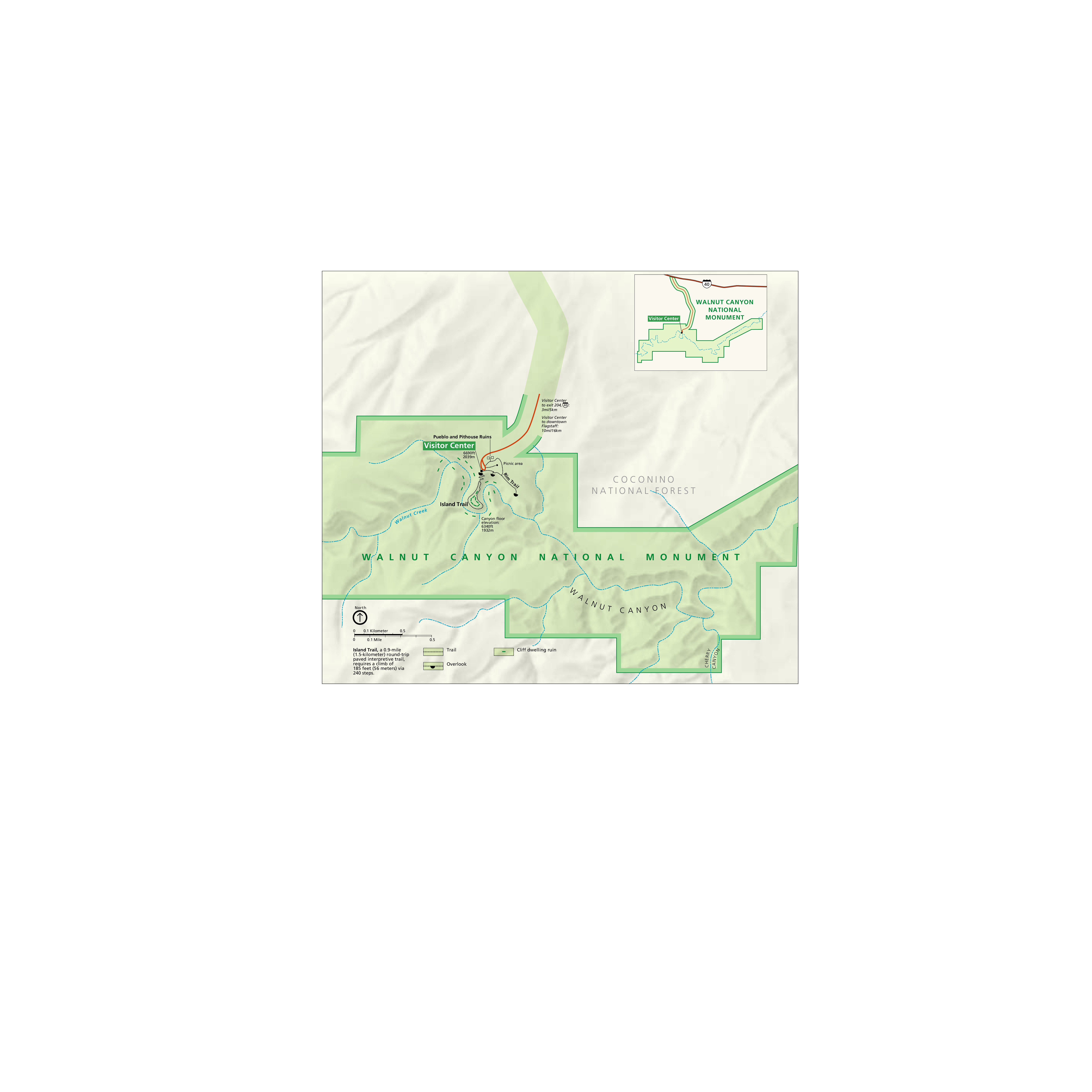
Park Map - Walnut Canyon National Monument
Map of Walnut Canyon National Monument in Arizona showing the canyon’s topography, visitor center, trails, ruins, and the Coconino National Forest to the north.
Screen-viewable file; Adobe print production files can be downloaded from the Compressed zip Version link
Map Projection: Other; Map Type: unassigned
U.S. National Park Service
The National Park Service maps are government produced and are in the public domain. Anyone may, without restriction under U.S. copyright laws: Reproduce the work in print or digital form; Create derivative works; Perform the work publicly; Display the work; Distribute copies or digitally transfer the work to the public by sale or other transfer of ownership, or by rental, lease, or lending. Please note, a user who modifies and/or republishes National Park Service maps are responsible for any problems encountered with the maps, due to their change or modification.
Public domain
Document
Walnut Canyon National Monument, Code: WACA
Walnut Canyon National Monument, Coconino County, Arizona
Latitude: 35.1682014465332, Longitude: -111.501998901367
Latitude: 35.1682014465332, Longitude: -111.501998901367
2018-06-21
Public Can View
Person: Harpers Ferry Center
Organization: US National Park Service
Address: Harpers Ferry Center, Harpers Ferry, WV
Email: HFC_Cartography@nps.gov
Organization: US National Park Service
Address: Harpers Ferry Center, Harpers Ferry, WV
Email: HFC_Cartography@nps.gov
Monday, May 2, 2022 11:08:12 PM
Friday, September 26, 2025 11:38:08 PM
WACAmap1.pdf
pdf
91.9 kB
Map