Select Item below to DOWNLOAD - Once item is selected, right click and choose 'save as'
e967a4d1c68746f295450dd954a5900e
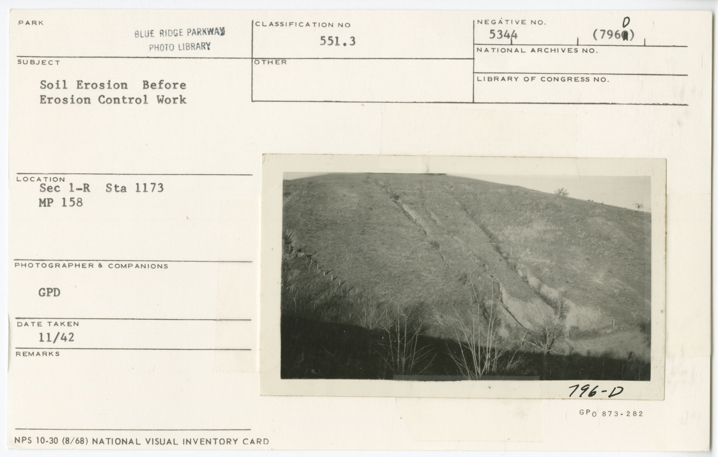
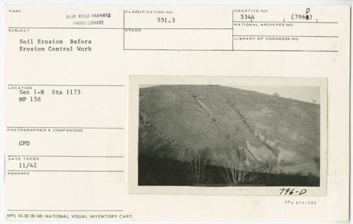
Soil erosion before control work
Soil erosion before control work
Section 1-R, Station 1173, Milepost 158
U.S. National Park Service
Permission must be secured from the individual copyright owners to reproduce any copyrighted materials contained within this website.
GPD
Public domain
Image
Blue Ridge Parkway, Code: BLRI
Milepost 158, Blue Ridge Parkway
Blue Ridge Parkway
Latitude: 36.4365005493164, Longitude: -81.070556640625
Blue Ridge Parkway
Latitude: 36.4365005493164, Longitude: -81.070556640625
November 1942
11/01/1942 - 11/29/1942
Public Can View
Organization: US National Park Service
Role: Museum Curator
Address: Blue Ridge Parkway Headquarters
Email: blri_info@nps.gov
Role: Museum Curator
Address: Blue Ridge Parkway Headquarters
Email: blri_info@nps.gov
Thursday, January 9, 2020 2:34:59 PM
Thursday, January 9, 2020 2:34:59 PM
0007_mp0158.tif
tif
11.4 MB
Scenic
,
Historic