Select Item below to DOWNLOAD - Once item is selected, right click and choose 'save as'
e0d2ec38-2e99-4094-85ef-9a324c4ef861
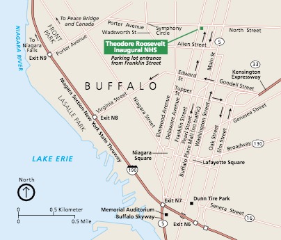
Park Map - Theodore Roosevelt Inaugural National Historic Site
Map of Theodore Roosevelt Inaugural National Historic Site in Buffalo, New York. The historic site is marked with a green square near the upper right corner of the map. The surrounding area is beige with streets represented by white lines and highways in red.
Screen-viewable file
Map Projection: WM; Map Type: area
U.S. National Park Service
The National Park Service maps are government produced and are in the public domain. Anyone may, without restriction under U.S. copyright laws: Reproduce the work in print or digital form; Create derivative works; Perform the work publicly; Display the work; Distribute copies or digitally transfer the work to the public by sale or other transfer of ownership, or by rental, lease, or lending. Please note, a user who modifies and/or republishes National Park Service maps are responsible for any problems encountered with the maps, due to their change or modification.
Public domain
Document
Theodore Roosevelt Inaugural National Historic Site, Code: THRI
Theodore Roosevelt Inaugural National Historic Site, Erie County, New York
Latitude: 42.9015007019043, Longitude: -78.8723983764648
Latitude: 42.9015007019043, Longitude: -78.8723983764648
2018-08-27
Public Can View
Person: Harpers Ferry Center
Organization: US National Park Service
Address: Harpers Ferry Center, Harpers Ferry, WV
Email: HFC_Cartography@nps.gov
Organization: US National Park Service
Address: Harpers Ferry Center, Harpers Ferry, WV
Email: HFC_Cartography@nps.gov
Monday, May 2, 2022 10:42:20 PM
Friday, September 26, 2025 11:37:47 PM
THRI_AreaMap.pdf
pdf
394.8 kB
Map