Select Item below to DOWNLOAD - Once item is selected, right click and choose 'save as'
C4EA7526-1DD8-B71C-073991D2D6A47209
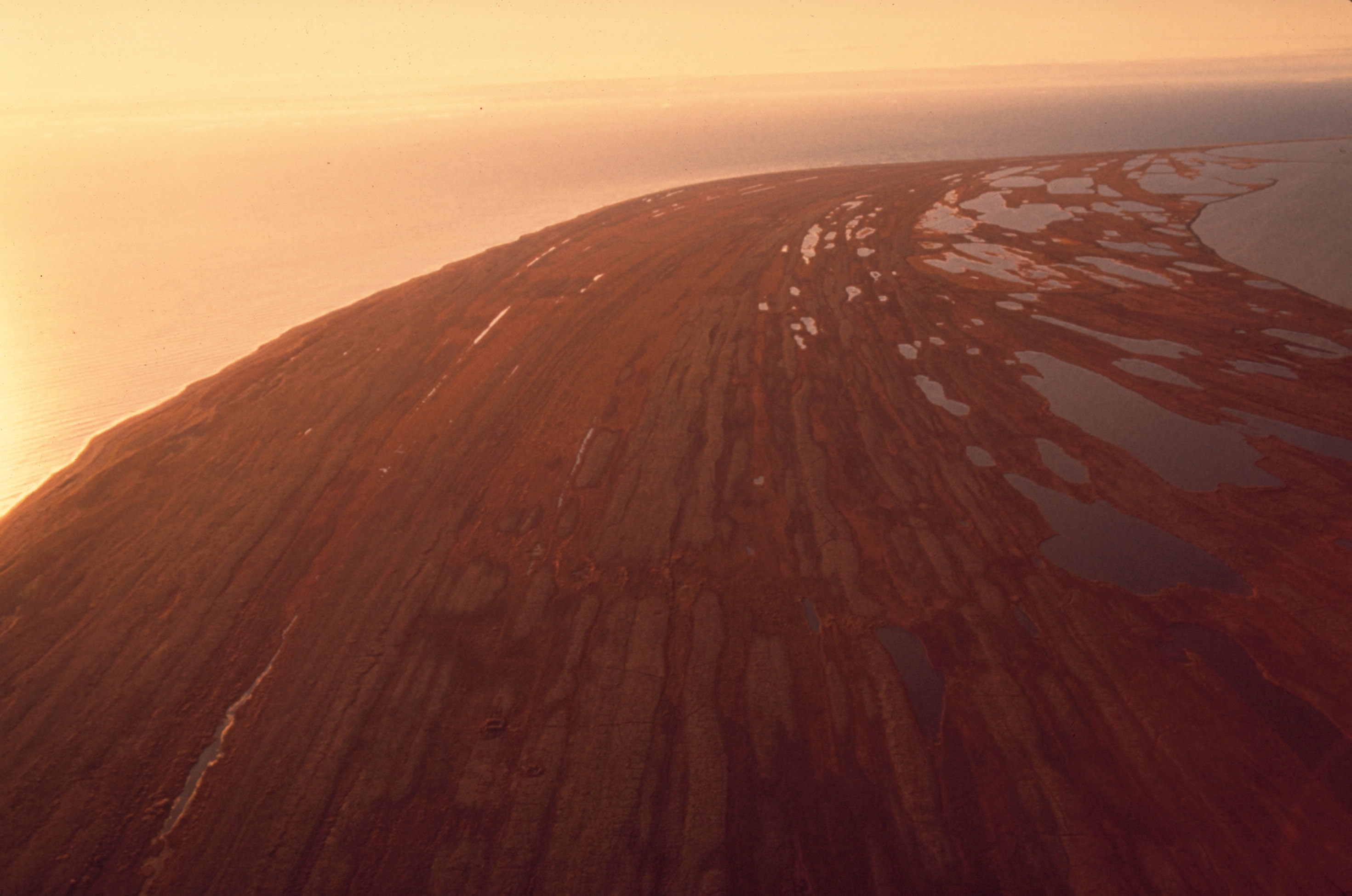
Beach Ridges on the Shore of Cape Krusenstern
Aerial view of beach ridges on a coastline
Beach ridges created by years of wave action during storms can be seen as parallel lines in the fall vegetation covering the old gravel. People have lived and traveled on this beach to hunt sea mammals for 5000 years.
U.S. National Park Service
Permission must be secured from the individual copyright owners to reproduce any copyrighted materials contained within this website. Digital assets without any copyright restrictions are public domain.
NPS Photo
Public domain:Full Granting Rights
Image
Cape Krusenstern National Monument, Code: CAKR
Cape Krusenstern National Monument, Northwest Arctic Borough, Alaska
Latitude: 67.4122009277344, Longitude: -163.503005981445
Latitude: 67.4122009277344, Longitude: -163.503005981445
1/30/2013 12:20:04 PM
Public Can View
Thursday, May 3, 2018 8:49:54 AM
Thursday, May 3, 2018 8:49:54 AM
C4EB4D3C-1DD8-B71C-07AAE63F8524B16A.jpg
Wednesday, January 30, 2013 7:20:04 PM
jpg
1.6 MB
Scenic