Select Item below to DOWNLOAD - Once item is selected, right click and choose 'save as'
bf4fcb587de3470ca9070698ba5b53b3
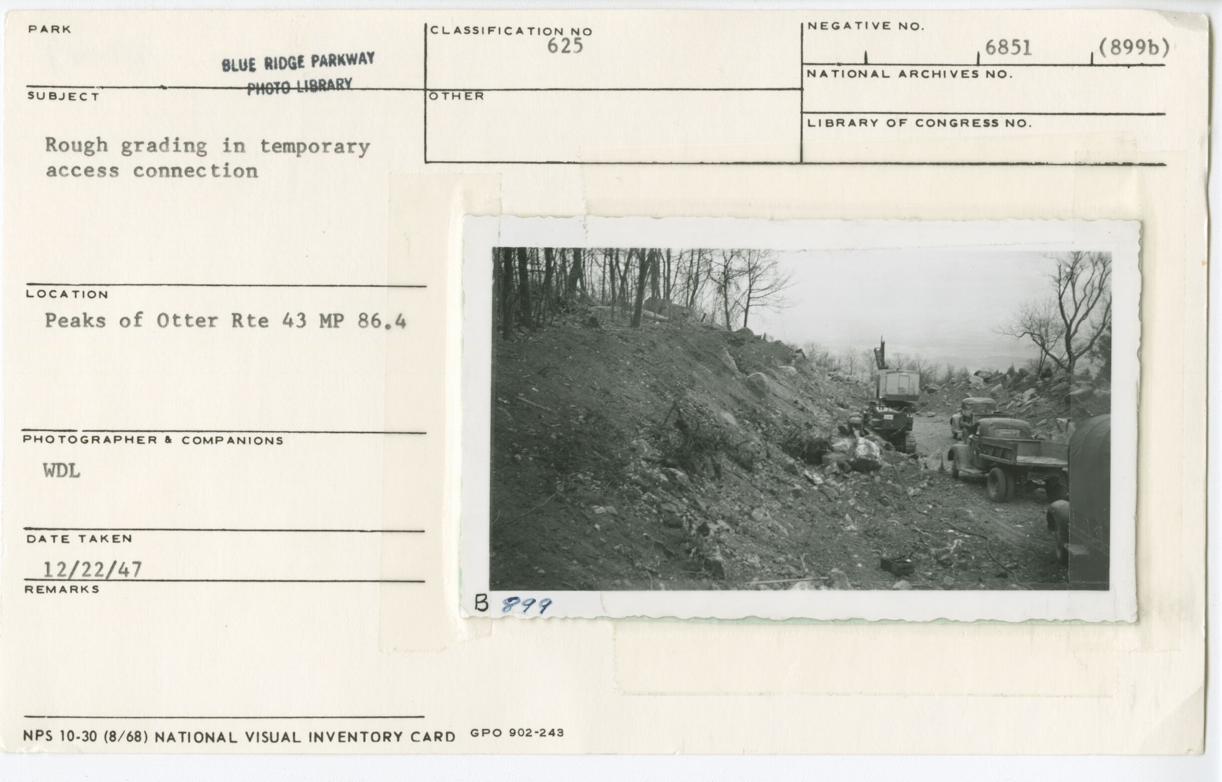
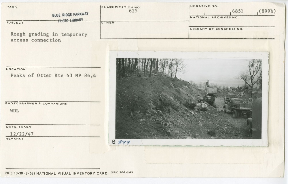
Rough grading in temporary access connection
Rough grading in temporary access connection
Peaks of Otter, Milepost 86.4, Blue Ridge Parkway
U.S. National Park Service
Permission must be secured from the individual copyright owners to reproduce any copyrighted materials contained within this website.
Warren D. Lewis
Public domain
Image
Blue Ridge Parkway, Code: BLRI
Milepost 86, Blue Ridge Parkway
Blue Ridge Parkway
Latitude: 36.4365005493164, Longitude: -81.070556640625
Blue Ridge Parkway
Latitude: 36.4365005493164, Longitude: -81.070556640625
December 22, 1947
12/22/1947
Public Can View
Organization: US National Park Service
Role: Museum Curator
Address: Blue Ridge Parkway Headquarters
Email: blri_info@nps.gov
Role: Museum Curator
Address: Blue Ridge Parkway Headquarters
Email: blri_info@nps.gov
Monday, February 3, 2020 3:25:35 PM
Monday, February 3, 2020 3:25:35 PM
0250_johnson_farm.tif
tif
11.5 MB
Scenic
,
Historic