Select Item below to DOWNLOAD - Once item is selected, right click and choose 'save as'
b9faeb49a7e04c6b920954c3d113d4d9
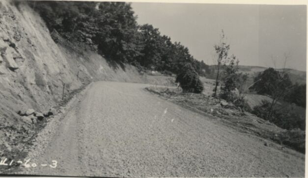
Camera 10' left, Station 77+76 (Route 56), ahead, first course surfacing
Camera 10' left, Station 77+76 (Route 56), ahead, first course surfacing
Photographs from the Blue Ridge Parkway Final Construction Report, Project 1-E-1, June 12, 1943
U.S. National Park Service
Permission must be secured from the individual copyright owners to reproduce any copyrighted materials contained within this website.
Unknown
Public domain
Roadway, (Blue Ridge Parkway Construction Project)
Image
Blue Ridge Parkway, Code: BLRI
Section 1-E, Milepost 27.2-37.5, Blue Ridge Parkway
Blue Ridge Parkway
Latitude: 36.4365005493164, Longitude: -81.070556640625
Blue Ridge Parkway
Latitude: 36.4365005493164, Longitude: -81.070556640625
circa 1940s
Public Can View
Organization: US National Park Service
Role: Museum Curator
Address: Blue Ridge Parkway Headquarters
Email: blri_info@nps.gov
Role: Museum Curator
Address: Blue Ridge Parkway Headquarters
Email: blri_info@nps.gov
Sunday, March 22, 2020 10:04:02 AM
Sunday, March 22, 2020 10:04:02 AM
BLRI_FinalConstrRpt_1-E115.tif
tif
683.8 kB
Scenic
,
Historic