Select Item below to DOWNLOAD - Once item is selected, right click and choose 'save as'
b8bfad5b-9e20-4a7e-a1da-453cf082a7fc
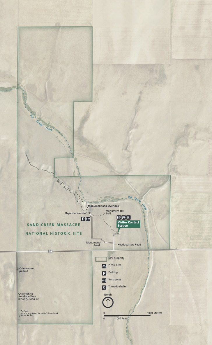
Park Map - Sand Creek Massacre National Historic Site
Map of Sand Creek Massacre National Historic Site in Colorado. Shown against tan terrain and overlapping the blue Big Sandy Creek, a blocky green border encloses a Visitor Contact Station and other sites and amenities.
Screen-viewable file; Adobe print production files can be downloaded from the Compressed zip Version link
Map Projection: WM; Map Type: park map
U.S. National Park Service
The National Park Service maps are government produced and are in the public domain. Anyone may, without restriction under U.S. copyright laws: Reproduce the work in print or digital form; Create derivative works; Perform the work publicly; Display the work; Distribute copies or digitally transfer the work to the public by sale or other transfer of ownership, or by rental, lease, or lending. Please note, a user who modifies and/or republishes National Park Service maps are responsible for any problems encountered with the maps, due to their change or modification.
Public domain
Document
Sand Creek Massacre National Historic Site, Code: SAND
Sand Creek Massacre National Historic Site, Kiowa County, Colorado
Latitude: 38.5640983581543, Longitude: -102.516998291016
Latitude: 38.5640983581543, Longitude: -102.516998291016
2020-04-08
Public Can View
Person: Harpers Ferry Center
Organization: US National Park Service
Address: Harpers Ferry Center, Harpers Ferry, WV
Email: HFC_Cartography@nps.gov
Organization: US National Park Service
Address: Harpers Ferry Center, Harpers Ferry, WV
Email: HFC_Cartography@nps.gov
Monday, May 2, 2022 10:17:26 PM
Friday, September 26, 2025 11:37:33 PM
SANDmap4.pdf
pdf
5.0 MB
Map