, Beaches, ()
, Seashore, ()
, Islands, ()
, Wild flowers, ()
, Park rangers, ()
, National Park Service staff in the field, ()
, Sailboats, ()
Latitude: 34.0039100646973, Longitude: -119.725196838379
URL: http://www.nps.gov/pub_aff/imagebase.html
Address: 1901 Spinnaker Drive
Cuyler Harbor, San Miguel Island
Harris and Lester Points, San Miguel Island
Sea Cliff
Park ranger talking to a camper in a foggy canyon
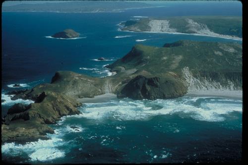
Cuyler Harbor and Harris Point, San Miguel Island
Prince Island
Park Rangers at camp
Harris Point, San Miguel Island
Sailboat in Culyer Harbor, San Miguel Island
Cuyler Harbor, San Miguel Island
Pink flower in dry grass
Cuyler Harbor, San Miguel Island