Select Item below to DOWNLOAD - Once item is selected, right click and choose 'save as'
8f7d969774df44e792b75e76ebc7e17c
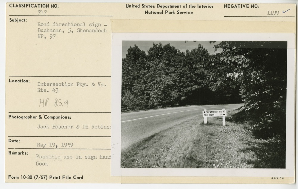
Directional sign showing Buchanan and Shenandoah National Park distances
Directional sign showing Buchanan and Shenandoah National Park distances
Intersection Parkway & VA Route 43, Milepost 85.9, Blue Ridge Parkway
U.S. National Park Service
Permission must be secured from the individual copyright owners to reproduce any copyrighted materials contained within this website.
Jack E. Boucher and Donald H. Robinson
Public domain
Image
Blue Ridge Parkway, Code: BLRI
Milepost 85, Blue Ridge Parkway
Blue Ridge Parkway
Latitude: 36.4365005493164, Longitude: -81.070556640625
Blue Ridge Parkway
Latitude: 36.4365005493164, Longitude: -81.070556640625
May 19, 1959
05/19/1959
Public Can View
Organization: US National Park Service
Role: Museum Curator
Address: Blue Ridge Parkway Headquarters
Email: blri_info@nps.gov
Role: Museum Curator
Address: Blue Ridge Parkway Headquarters
Email: blri_info@nps.gov
Wednesday, January 8, 2020 3:36:18 PM
Wednesday, January 8, 2020 3:36:18 PM
0004_p_otter_area.tif
tif
11.7 MB
Scenic
,
Historic