Select Item below to DOWNLOAD - Once item is selected, right click and choose 'save as'
8aad08f4-8699-4008-8913-687d631c4db0
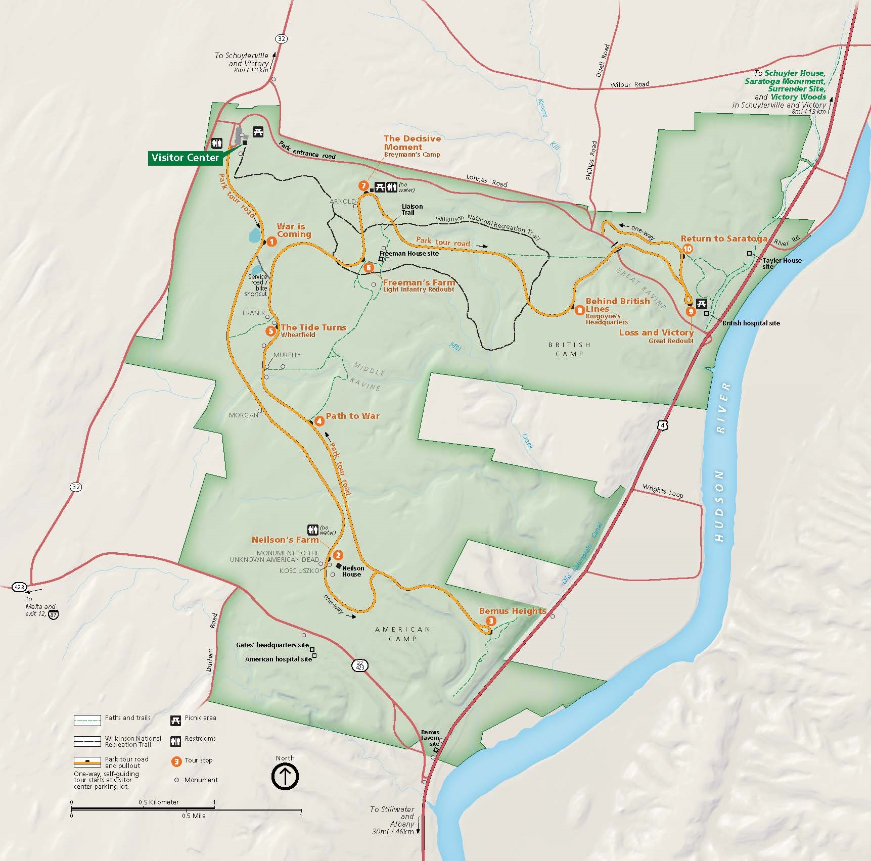
Park Map - Saratoga National Historical Park
Map of Saratoga National Historical Park in New York. The park area, shown in green, is shaped like a blocky letter E. West of the Hudson, the park touches the riverbank at two points. The map shows roads around and through the park, including the self-guiding park tour, as well as paths and trails.
Screen-viewable file; Adobe print production files can be downloaded from the Compressed zip Version link
Map Projection: WM; Map Type: park map
U.S. National Park Service
The National Park Service maps are government produced and are in the public domain. Anyone may, without restriction under U.S. copyright laws: Reproduce the work in print or digital form; Create derivative works; Perform the work publicly; Display the work; Distribute copies or digitally transfer the work to the public by sale or other transfer of ownership, or by rental, lease, or lending. Please note, a user who modifies and/or republishes National Park Service maps are responsible for any problems encountered with the maps, due to their change or modification.
Public domain
Document
Saratoga National Historical Park, Code: SARA
Saratoga National Historical Park, Saratoga County, New York
Latitude: 42.9943008422852, Longitude: -73.6440963745117
Latitude: 42.9943008422852, Longitude: -73.6440963745117
2022/06/01
Public Can View
Person: Harpers Ferry Center
Organization: US National Park Service
Address: Harpers Ferry Center, Harpers Ferry, WV
Email: HFC_Cartography@nps.gov
Organization: US National Park Service
Address: Harpers Ferry Center, Harpers Ferry, WV
Email: HFC_Cartography@nps.gov
Monday, May 2, 2022 10:16:36 PM
Friday, September 26, 2025 11:37:37 PM
SARAParkMap.pdf
pdf
4.9 MB
Map