Select Item below to DOWNLOAD - Once item is selected, right click and choose 'save as'
8959424650e24048a20060f0256e053e
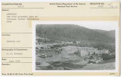
Dam site proposed at Sherando National Forest Recreation Area
Dam site proposed at Sherando National Forest Recreation Area
Section 1-C
U.S. National Park Service
Permission must be secured from the individual copyright owners to reproduce any copyrighted materials contained within this website.
E. H. Abbuehl
Public domain
Image
Blue Ridge Parkway, Code: BLRI
Blue Ridge Parkway
Latitude: 36.4365005493164, Longitude: -81.070556640625
Latitude: 36.4365005493164, Longitude: -81.070556640625
June 1934
06/01/1934 - 06/29/1934
Public Can View
Organization: US National Park Service
Role: Museum Curator
Address: Blue Ridge Parkway Headquarters
Email: blri_info@nps.gov
Role: Museum Curator
Address: Blue Ridge Parkway Headquarters
Email: blri_info@nps.gov
Friday, January 10, 2020 9:09:42 AM
Friday, January 10, 2020 9:09:42 AM
0013_mp0007.tif
tif
11.5 MB
Scenic
,
Historic