Select Item below to DOWNLOAD - Once item is selected, right click and choose 'save as'
693cde56-8c31-4ce5-a48f-230fcf3efd70
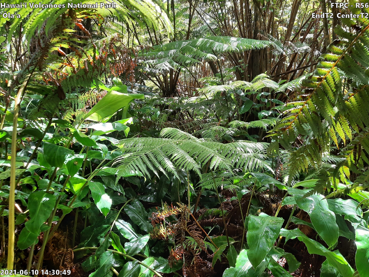
Wet Forest ʻŌlaʻa: Site R56 - EndT2_CenterT2, 2021
Eye-level view of plant community at monitoring site
FTPC HAVO Wet Forest ʻŌlaʻa: Rotational Site 56 - EndT2_CenterT2
U.S. National Park Service
Copyright free and in the public domain
NPS Photo / John Benner
Public domain
Wet Forest, (PACN-CommunityType)
, Ola'a, (PACN-SamplingFrameName)
, ʻŌlaʻa, (PACN-SamplingFrameNameDiacritical)
, Rotational, (PACN-PlotType)
, 56, (PACN-Transect)
, Focal Terrestrial Plant Communities, (PACN-ProtocolName)
, Ola'a, (PACN-SamplingFrameName)
, ʻŌlaʻa, (PACN-SamplingFrameNameDiacritical)
, Rotational, (PACN-PlotType)
, 56, (PACN-Transect)
, Focal Terrestrial Plant Communities, (PACN-ProtocolName)
Image
Pacific Island Network, Code: PACN
Hawaii Volcanoes National Park, Code: HAVO
Hawaii Volcanoes National Park, Code: HAVO
Hawaiʻi Volcanoes National Park
Hawaii Volcanoes National Park, Hawaii County, Hawaii
Latitude: 19.3775997161865, Longitude: -155.602996826172
Hawaii Volcanoes National Park, Hawaii County, Hawaii
Latitude: 19.3775997161865, Longitude: -155.602996826172
6/10/2021 14:30
01/01/2021 - 12/30/2021
Public Can View
Person: Botanist
Organization: US National Park Service
Address: Pacific Island Network, Hawaiʻi National Park, HI 96718
Organization: US National Park Service
Address: Pacific Island Network, Hawaiʻi National Park, HI 96718
Tuesday, January 23, 2024 12:10:40 AM
Tuesday, January 23, 2024 12:10:40 AM
20210610_R56_EndT2_CenterT2.jpg
jpg
3.3 MB
Monitoring