Select Item below to DOWNLOAD - Once item is selected, right click and choose 'save as'
4c0b9e31-5625-4b15-9d2a-d40c9d3a3b0f
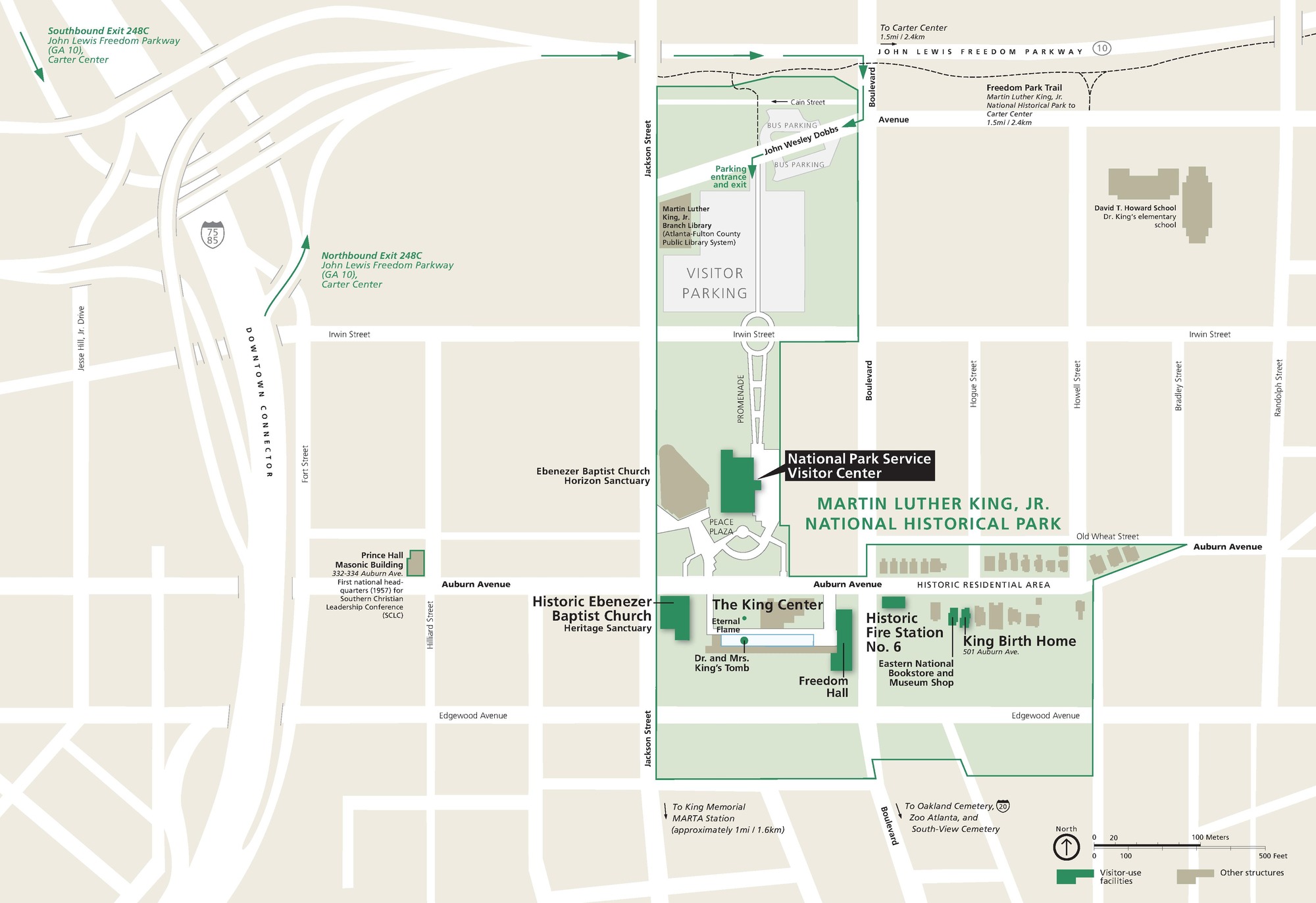
Park Map - Martin Luther King, Jr. National Historical Park
Map of Martin Luther King, Jr. National Historical Park in Atlanta, Georgia. Park property is indicated in green, occupying several blocks east of Jackson Street and south of State Route 10, which is also labeled the John Lewis Freedom Parkway.
Screen-viewable file; Adobe print production files can be downloaded from the Compressed zip Version link
Map Projection: Other; Map Type: park map
U.S. National Park Service
The National Park Service maps are government produced and are in the public domain. Anyone may, without restriction under U.S. copyright laws: Reproduce the work in print or digital form; Create derivative works; Perform the work publicly; Display the work; Distribute copies or digitally transfer the work to the public by sale or other transfer of ownership, or by rental, lease, or lending. Please note, a user who modifies and/or republishes National Park Service maps are responsible for any problems encountered with the maps, due to their change or modification.
Public domain
Document
Martin Luther King, Jr. National Historical Park, Code: MALU
Martin Luther King, Jr. National Historical Park, Georgia
Martin Luther King, Jr. National Historical Park, Fulton County, Georgia
Latitude: 33.7549018859863, Longitude: -84.371696472168
Martin Luther King, Jr. National Historical Park, Fulton County, Georgia
Latitude: 33.7549018859863, Longitude: -84.371696472168
2020-04-13
Public Can View
Person: Harpers Ferry Center
Organization: US National Park Service
Address: Harpers Ferry Center, Harpers Ferry, WV
Email: HFC_Cartography@nps.gov
Organization: US National Park Service
Address: Harpers Ferry Center, Harpers Ferry, WV
Email: HFC_Cartography@nps.gov
Wednesday, April 27, 2022 8:30:10 PM
Friday, September 26, 2025 11:36:28 PM
MALUmap1.pdf
pdf
726.2 kB
Map