Select Item below to DOWNLOAD - Once item is selected, right click and choose 'save as'
19800e06-2e94-49ff-8f05-15b1892d0cf6
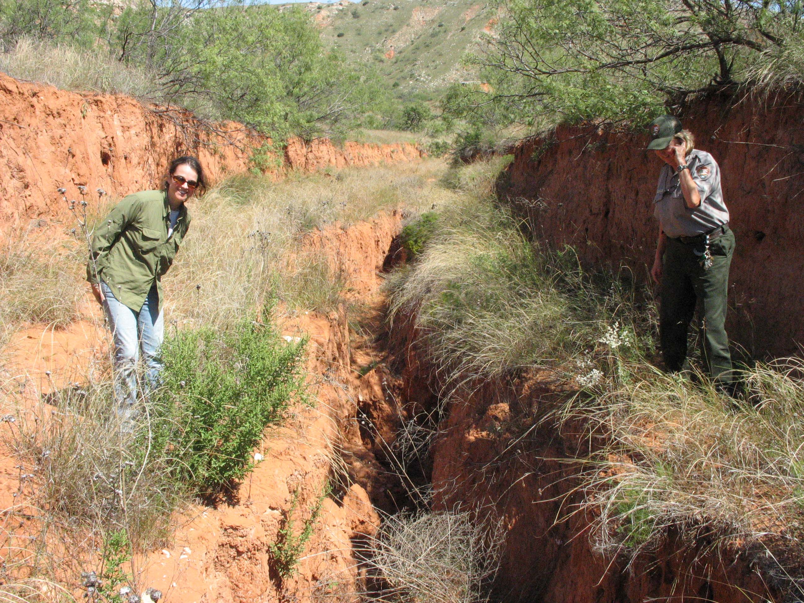
road conditions 1 at LAMR in Feb 2009
LAMR has a high probability of discovery of archaeological materials and these roads cuts are creating severe erosion.
deep erosional cut -
Permission must be secured from the individual copyright owners to reproduce any copyrighted materials contained within this website. Digital assets without any copyright restrictions are public domain.
Public domain
Image
Lake Meredith National Recreation Area, Code: LAMR
LAMR- northwest side of lake, Lake Meredith National Recreation Area, Texas
Latitude: 35.5958595275879, Longitude: -101.69709777832
Latitude: 35.5958595275879, Longitude: -101.69709777832
09/17/2008
02/28/2009
Public Can View
Monday, March 2, 2009 7:35:46 AM
Wednesday, August 9, 2017 1:13:18 PM
LAMR-af8ff43d89774ab78da1ba001a7ee003.jpg
Canon Canon, Canon PowerShot A610
1/1250 sec at f / 7.1
7.3 mm
Wednesday, September 17, 2008 4:39:26 PM
jpg
881.9 kB
Budget