Select Item below to DOWNLOAD - Once item is selected, right click and choose 'save as'
15bac7fb-89e1-4771-b898-5a33c3024ed7
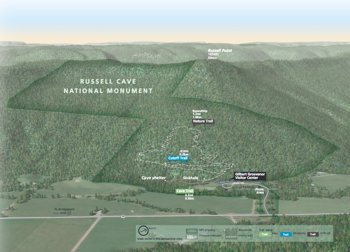
3D Park Map - Russell Cave National Monument
3D park map of Russell Cave National Monument in Alabama. A diagonally oriented bowtie-shaped area outlined in green represents the boundaries of the site with trails and other landmarks marked throughout the lower half of the forested landscape.
Screen-viewable file; Adobe print production files can be downloaded from the Compressed zip Version link
Map Projection: 3D; Map Type: park map
U.S. National Park Service
The National Park Service maps are government produced and are in the public domain. Anyone may, without restriction under U.S. copyright laws: Reproduce the work in print or digital form; Create derivative works; Perform the work publicly; Display the work; Distribute copies or digitally transfer the work to the public by sale or other transfer of ownership, or by rental, lease, or lending. Please note, a user who modifies and/or republishes National Park Service maps are responsible for any problems encountered with the maps, due to their change or modification.
Public domain
Document
Russell Cave National Monument, Code: RUCA
Russell Cave National Monument, Jackson County, Alabama
Latitude: 34.9707984924316, Longitude: -85.818603515625
Latitude: 34.9707984924316, Longitude: -85.818603515625
2018-06-14
Public Can View
Person: Harpers Ferry Center
Organization: US National Park Service
Address: Harpers Ferry Center, Harpers Ferry, WV
Email: HFC_Cartography@nps.gov
Organization: US National Park Service
Address: Harpers Ferry Center, Harpers Ferry, WV
Email: HFC_Cartography@nps.gov
Monday, May 2, 2022 9:37:23 PM
Friday, September 26, 2025 11:37:18 PM
RUCAmap1.pdf
pdf
17.5 MB
Map