Select Item below to DOWNLOAD - Once item is selected, right click and choose 'save as'
a24a12d2eefd481f885e26e7096413bf
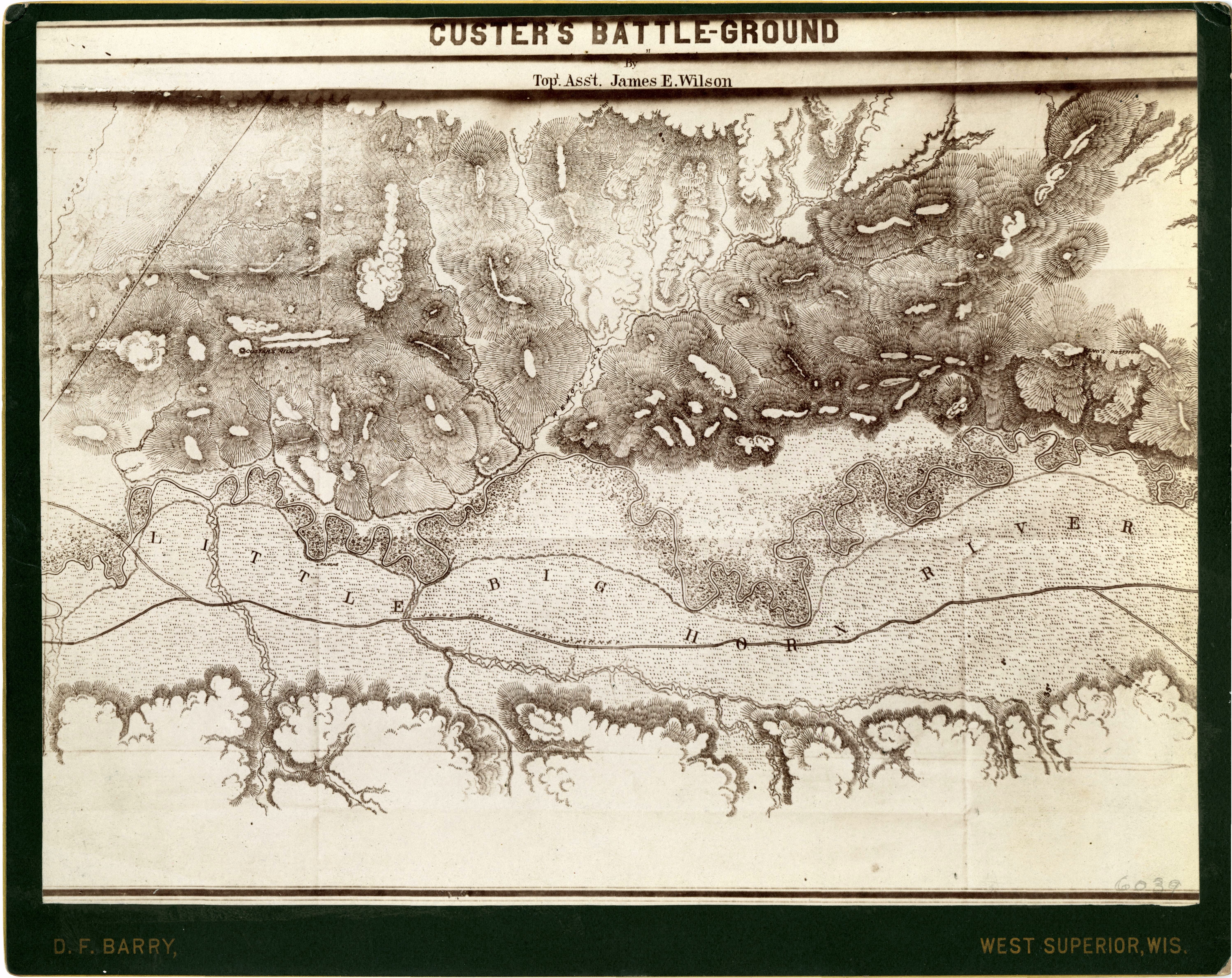
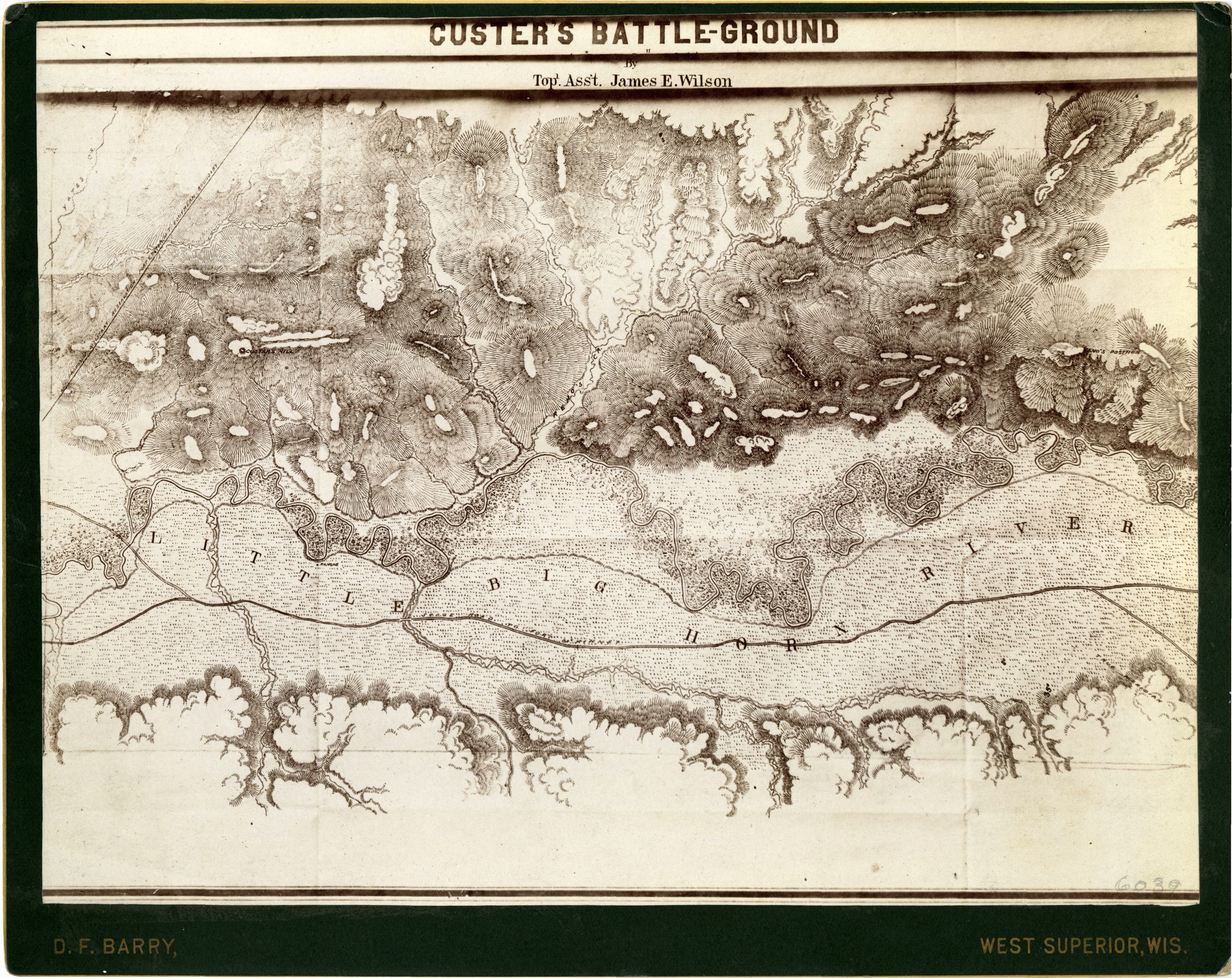
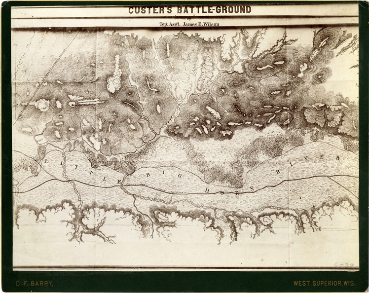
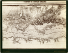
Topographic Map of 'Custer's Battle-Ground' by Topographic Assistant James E. Wilson
LIBI_00081_06039; Photograph size 7" x 9 1/4" mounted on 8" x 10" heavy black card-board with gilt-edged. The image depicts the area of Custer's battle ground. “Custer’s Battle-Ground by Top. Asst. James E. Wilson” is printed along the top. It was produced by topographic assistant James E. Wilson. The photograph is by D.F. Barry.Dustin number: 285; map; Courtesy of the National Park Service, Little Bighorn Battlefield National Monument, LIBI_00081_06039, D. F. Barry, "Topographic Map of 'Custer's Battle-Ground' by Topographic Assistant James E. Wilson," date unknown
National Park Service
Courtesy of the National Park Service, Little Bighorn Battlefield National Monument, LIBI_00081_06039, D F. Barry, "Topographic Map of 'Custer's Battle-Ground' by Topographic Assistant James E. Wilson," date unknown
Public domain
image
Little Bighorn Battlefield National Monument, Code: LIBI
Little Bighorn Battlefield National Monument, Big Horn County, Montana
Latitude: 45.5651016235352, Longitude: -107.429000854492
Latitude: 45.5651016235352, Longitude: -107.429000854492
Title: Little Bighorn Battlefield National Monument Historic Photo Collection
URL: https://www.nps.gov/libi
URL: https://www.nps.gov/libi
unknown
Organization: Little Bighorn Battlefield National Monument
Position: Research Requests
Address: PO Box 39, Crow Agency, MT, USA, 59033, (406) 638-2621
Email: libi_librarian@nps.gov
Position: Research Requests
Address: PO Box 39, Crow Agency, MT, USA, 59033, (406) 638-2621
Email: libi_librarian@nps.gov
Thursday, May 24, 2018 12:43:54 PM
Thursday, May 24, 2018 12:43:54 PM
LIBI_00081_06039A.tif
tif
85.6 MB
Historic