Select Item below to DOWNLOAD - Once item is selected, right click and choose 'save as'
fc638794-a47c-4edb-90f6-d8503de1abcb
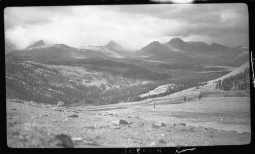
Tyndall Creek, 11,500', Upper Kern River Basin, Subalpine Forest Plant Community, Type Map.
SEKI Historic Image
Tyndall Creek, 11,500', Upper Kern River Basin, Subalpine Forest Plant Community, Type Map.
National Park Service
R.D. Roseberry, 360904, Bighorn Plateau, SNP, Tyndall Creek, 11,500', Upper Kern River Basin, Subalpine Forest Plant Community, Type Map.
Permission must be secured from the individual copyright owners to reproduce any copyrighted materials contained within this website. Digital assets without any copyright restrictions are public domain.
Public domain
Image
Bighorn Plateau, Tulare County, California
09/04/1936
option 1
Public Can View
Tuesday, January 10, 2017 1:01:36 PM
Tuesday, January 10, 2017 1:01:36 PM
08214.tif
Monday, January 1, 0001 12:00:00 AM
tif
15.1 MB
Scenic
,
Historic