Select Item below to DOWNLOAD - Once item is selected, right click and choose 'save as'
f2086288-3c02-46d3-b7f1-8b2d64d2fef7
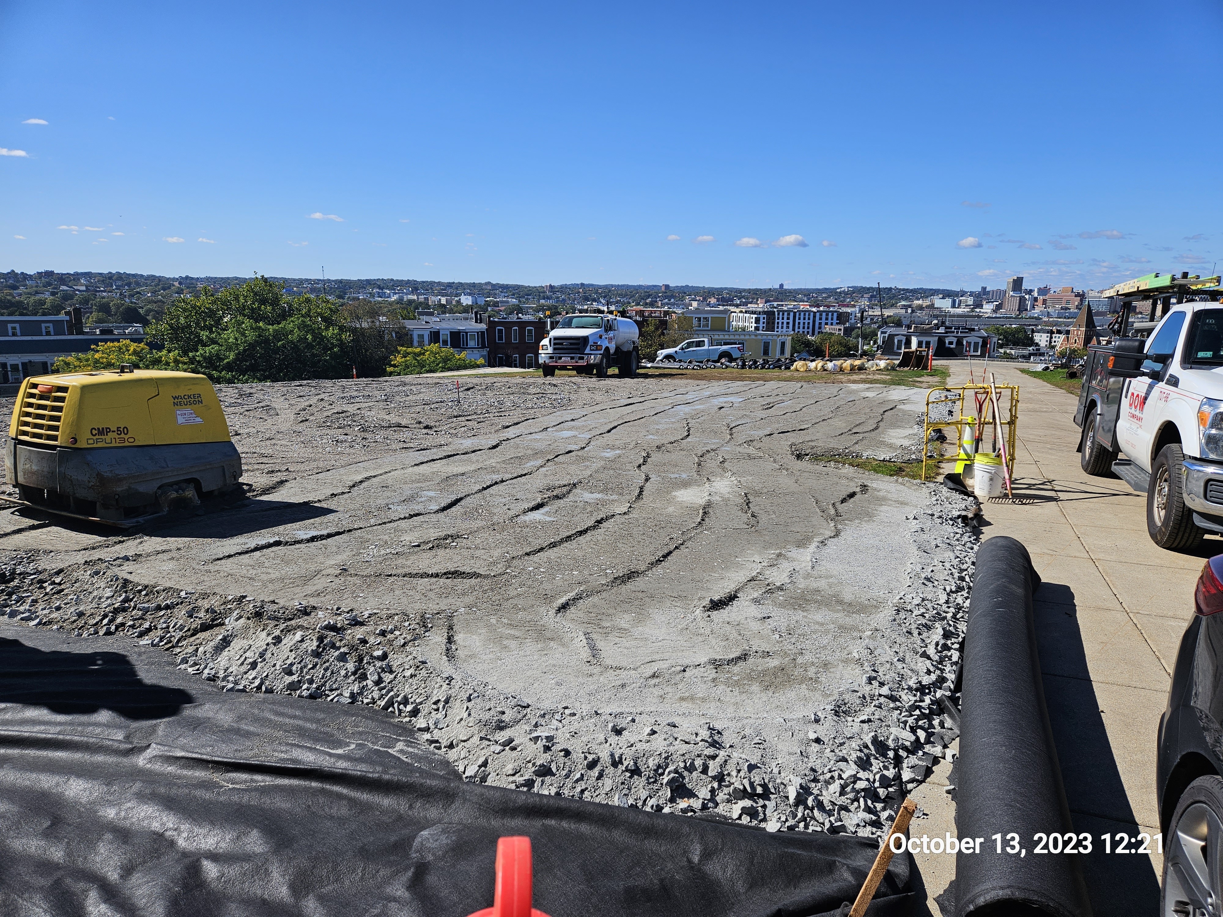
Lay down area compacting.
Grey crushed stone covers a black membrane over a large area. Irregular ridges streak across the grey stone area left by a yellow compactor that is to the left.
After placement of membrane, crushed stone form a stable foundation for a gravel lay down space that will minimize destruction to the ground below.
Permission must be secured from the individual copyright owners to reproduce any copyrighted materials contained within this website. Digital assets without any copyright restrictions are public domain.
All Rights Reserved:Full Granting Rights:Procon Consulting for the National Park Service.
Image
Boston National Historical Park, Code: BOST
Boston National Historical Park, Suffolk County, Massachusetts
Latitude: 42.3734016418457, Longitude: -71.0557022094727
Latitude: 42.3734016418457, Longitude: -71.0557022094727
10/13/2023
10/13/2023
Public Can View
Person: Boston National Historical Park
Organization: BOST
Organization: BOST
Wednesday, April 3, 2024 7:47:14 PM
Wednesday, April 3, 2024 8:09:20 PM
20231013_122158.jpg
samsung samsung, Galaxy S23
1/2551 sec at f / 1.8
5.4 mm
ISO 25
Friday, October 13, 2023 12:21:58 PM
jpg
4.9 MB
Monitoring