Select Item below to DOWNLOAD - Once item is selected, right click and choose 'save as'
F1B83DF0747547D2B59BB7A0FA98AB85
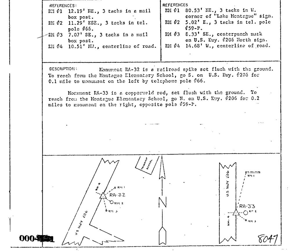
00008047 Monumentation Sketch of RA-33 in Delaware Water Gap National Recreation Area, 1966
Monumentation Sketch of RA-33 in Delaware Water Gap National Recreation Area, 1966. Sketch map of survey monument and immediate area.
Sketch map of survey monument and immediate area.
U. S. National Park Service
Set By NPS
This digital asset is in the public domain. When using this asset for any purpose, including online, credit: 'U.S. National Park Service, Land Resources Division'.
NPS / Tim Smith
Public domain
Image
Delaware Water Gap National Recreation Area, Code: DEWA
Delaware Water Gap National Recreation Area
Latitude: 41.1003189086914, Longitude: -74.9569320678711
Latitude: 41.1003189086914, Longitude: -74.9569320678711
MONUMENTID for Monuments : 00008047
2023/09/22
Public Can View
Organization: Land Resources Division
Position: Program Coordinator
Address: 1849 C Street, NW, Suite 2340, Main Interior Building, Washington, DC 20240
Position: Program Coordinator
Address: 1849 C Street, NW, Suite 2340, Main Interior Building, Washington, DC 20240
Monday, September 23, 2024 6:03:15 PM
Monday, September 23, 2024 6:03:15 PM
00008047.gif
gif
47.1 kB
Monitoring
,
Inventory
,
Map