Select Item below to DOWNLOAD - Once item is selected, right click and choose 'save as'
ef78a195-c4b5-4f03-950f-638dc8dece22
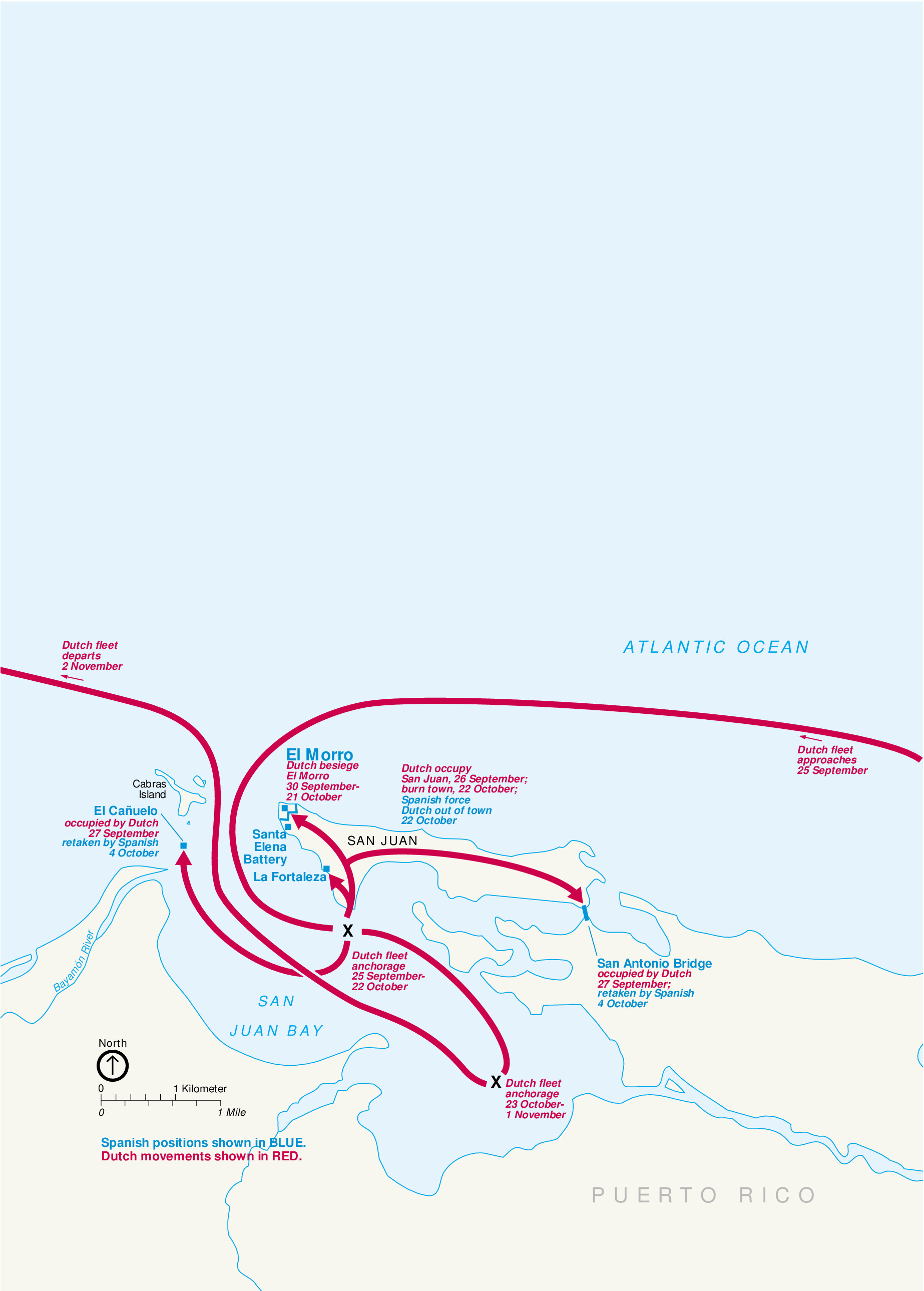
Battlemap - Dutch Attack 1625 - San Juan National Historic Site
Map of the Dutch Attack 1625 as part of San Juan National Historic Site in Puerto Rico. San Juan Bay is depicted in pale blue and it cuts into the coast of Puerto Rico, which is shown in white, stretching along the bottom edge of the map. A tangle of red arrows swoops by landmarks labeled in blue and red text.
Screen-viewable file; Adobe print production files can be downloaded from the Compressed zip Version link
Map Projection: Other; Map Type: unassigned
U.S. National Park Service
The National Park Service maps are government produced and are in the public domain. Anyone may, without restriction under U.S. copyright laws: Reproduce the work in print or digital form; Create derivative works; Perform the work publicly; Display the work; Distribute copies or digitally transfer the work to the public by sale or other transfer of ownership, or by rental, lease, or lending. Please note, a user who modifies and/or republishes National Park Service maps are responsible for any problems encountered with the maps, due to their change or modification.
Public domain
Document
San Juan National Historic Site, Code: SAJU
San Juan National Historic Site, Puerto Rico
Latitude: 18.4688205718994, Longitude: -66.1158828735352
Latitude: 18.4688205718994, Longitude: -66.1158828735352
2011-04-25
Public Can View
Person: Harpers Ferry Center
Organization: US National Park Service
Address: Harpers Ferry Center, Harpers Ferry, WV
Email: HFC_Cartography@nps.gov
Organization: US National Park Service
Address: Harpers Ferry Center, Harpers Ferry, WV
Email: HFC_Cartography@nps.gov
Monday, May 2, 2022 10:26:22 PM
Friday, September 26, 2025 11:37:31 PM
SAJUmap9.pdf
pdf
20.3 kB
Map