Select Item below to DOWNLOAD - Once item is selected, right click and choose 'save as'
ef2d13ba828746328c07b4d9403ca199
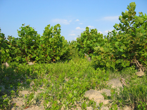
Sycamore - River Birch Floodplain Forest at Harpers Ferry NHP
Sycamore - River Birch Floodplain Forest at Harpers Ferry NHP
Photographer: Milo Pyne, courtesy of NatureServe
U.S. National Park Service
Creative Commons Attribution-NonCommercial 4.0 International (CC BY-NC 4.0): https://creativecommons.org/licenses/by-nc/4.0/
NPS / Milo Pyne;
Restrictions apply on use and/or reproduction (Copyrighted material):You are free to copy and redistribute the material in any medium or format and remix, transform, and build upon the material as long as you follow the Creative Commons Attribution-NonCommercial 4.0 International license terms available at https://creativecommons.org/licenses/by-nc/4.0/. For other uses, permission must be secured from the individual copyright owners.
Image
National Capital Region, Code: NCR
Harpers Ferry National Historical Park, Code: HAFE
Harpers Ferry National Historical Park, Code: HAFE
Harpers Ferry National Historical Park
Latitude: 39.312858581543, Longitude: -77.7419586181641
Latitude: 39.312858581543, Longitude: -77.7419586181641
2005/08/23
08/23/2005
Public Can View
Person: Program Manager
Organization: US National Park Service
Address: National Capital Region
Organization: US National Park Service
Address: National Capital Region
Tuesday, August 31, 2021 9:38:38 AM
Tuesday, August 31, 2021 9:38:38 AM
27305718797.jpg
jpg
1.3 MB
Scenic