Select Item below to DOWNLOAD - Once item is selected, right click and choose 'save as'
ee67b512-7ad7-4f45-b94c-0eb94d75d720
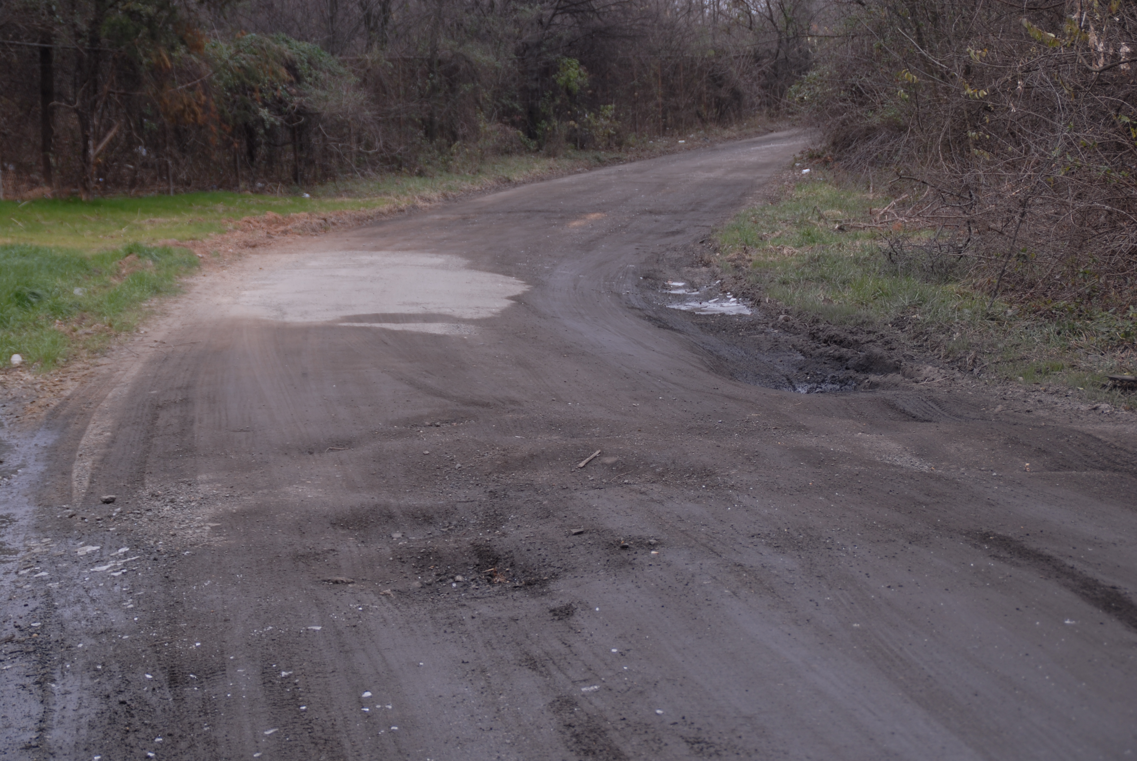
NACE- Resurface secondary gravel roads between Anacostia Park and River Terrace
Condition documentation for resurfacing secondary gravel roads between Anacostia Park and River Terrace
Pt. 1. Gravel road depicting pot holes between Anacostia Park, railroad tracks and East Capital Street Bridge.
U.S. National Park Service
Image taken facing south at 38¢ª 53.298 north by 76¢ª 57.726 west
Permission must be secured from the individual copyright owners to reproduce any copyrighted materials contained within this website. Digital assets without any copyright restrictions are public domain.
Public domain
Image
National Capital Parks-East, Code: NACE
National Capital Parks-East
Latitude: 38.9178695678711, Longitude: -76.9457473754883
Latitude: 38.9178695678711, Longitude: -76.9457473754883
02/01/2007
02/01/2007
Public Can View
Tuesday, February 6, 2007 1:48:24 PM
Thursday, August 10, 2017 12:25:44 PM
NACE-90dbb258edde48088702508abca2a23e.jpg
NIKON CORPORATION NIKON CORPORATION, NIKON D200
10/450 sec at f / 5
56 mm
ISO 100
Thursday, February 1, 2007 4:38:35 PM
jpg
4.3 MB
Budget